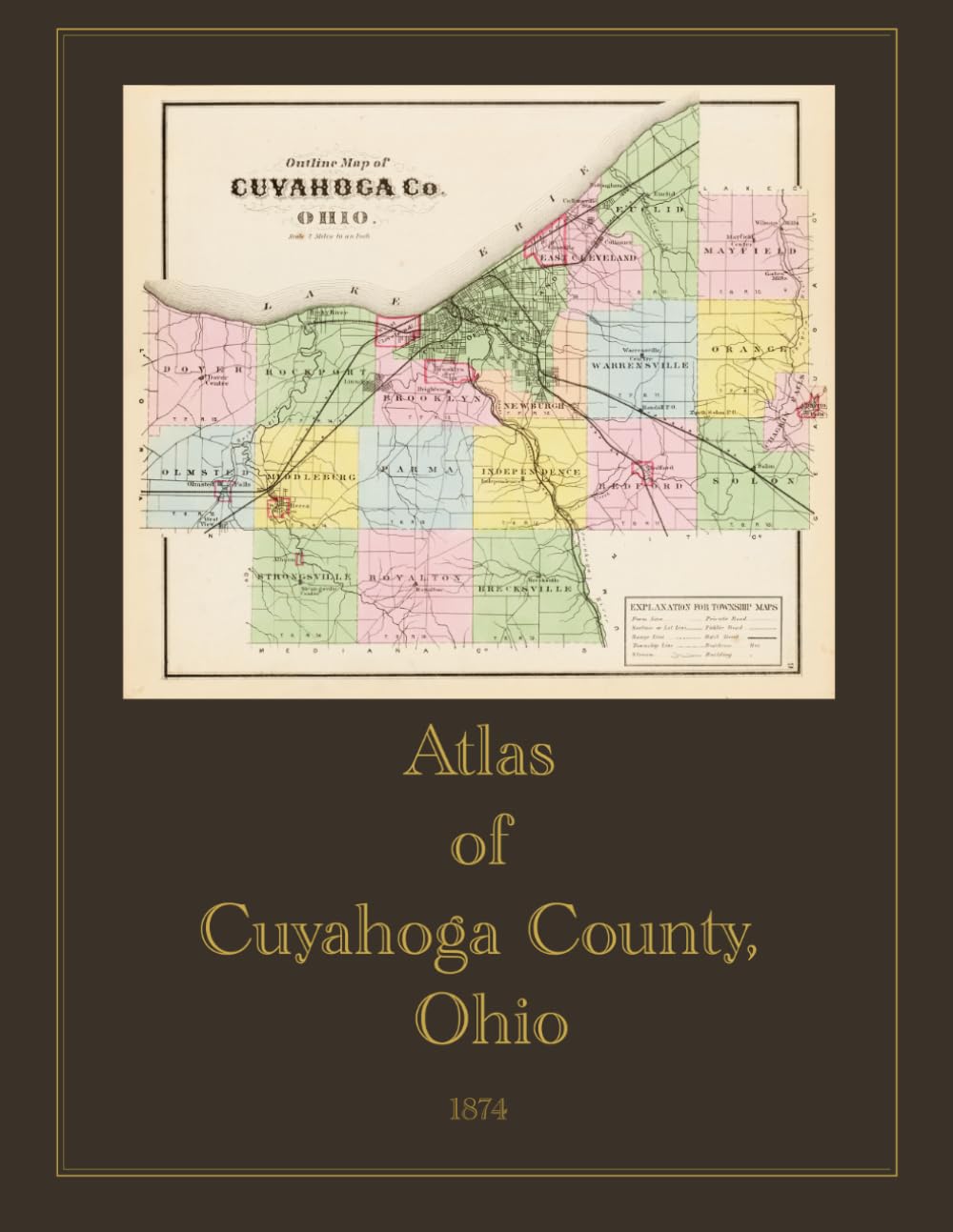
Originally published in Philadelphia in 1874 by Titus, Simmons & Titus, this full-color facsimile reprint reproduces the atlas compiled from actual surveys conducted under the direction of civil engineer D.J. Lake, with assistance from B.N. Griffing, F.L. Hayes, C.H. Edwards, J.P. Edwards, and A.C. Ferry. The maps were engraved by Worley & Bracher and printed by Fred Bourquin, with lithographic views by H.J. Toudy. The atlas documents Cuyahoga County and the City of Cleveland at a pivotal moment in the region's history — a period of rapid industrial and population growth following the Civil War. Cleveland's strategic position on Lake Erie had made the city a major transportation and manufacturing hub, and this atlas captures the county in remarkable detail just before Cleveland's centennial. Summary of Contents The atlas opens with an outline plan of Cuyahoga County and a table of distances and population. The bulk of the first half is devoted to the City of Cleveland, with detailed maps of all eighteen wards (including north and south sections of several wards, and east and west parts of the Fourteenth Ward), plus the Cleveland Business Directory. Township maps cover Bedford, Brecksville, Brooklyn, Chagrin Falls, Dover, East Cleveland, Euclid, Independence, Mayfield, Middleburg, Newburgh, Olmsted, Orange, Parma, Rockport, Royalton, Solon, Strongsville, and Warrensville. An index to towns and villages includes Albion, Bedford, Berea, Brecksville, Brighton, Broadway, Chagrin Falls, Collamer, Collinwood, Glenville, Grafton, Independence, Linndale, Newburgh, Nottingham, Olmsted Falls, Rocky River, Royalton, Solon, Strongsville, Warrensville, West Cleveland (North Part and South Part), and West View, among others — many of which have since been absorbed into present-day Cleveland. The atlas also features 129 lithographic views of residences, farms, commercial buildings, and public institutions, with an index listing the properties of over 150 individual subscribers. These views depict the architecture, landscapes, and daily life of Cuyahoga County's prosperous residents and local businesses, reflecting the subscription-based publishing model common to nineteenth-century county atlases. An essential reference for genealogists researching Cuyahoga County families, historians of Cleveland and northeastern Ohio, and collectors of nineteenth-century American cartography.