60 Hikes Within 60 Miles: San Antonio & Austin: Including the Hill Country
$18.06
by Charlie Llewellin
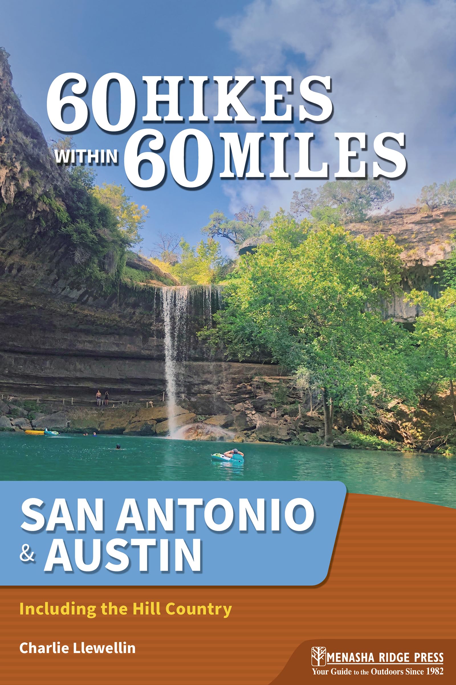
Get outdoors with this guide to 60 of the best hiking trails within an hour or so from San Antonio and Austin, Texas, leading you to scenic beauty. The best way to experience south-central Texas is by hiking it! Get into nature with local author and hiking expert Charlie Llewellin. This full-color guide helps you locate and access the top hikes within 60 miles of San Antonio or Austin. The selected trails transport you to scenic overlooks, wildlife hot spots, and historical settings that renew your spirit and recharge your body. Immerse yourself in history along the San Antonio Mission Trail, featuring two missions and within a few miles of the Alamo. Surround yourself in natural beauty on the Hamilton Pool Preserve Trail, with sights like the famous grotto and plenty of wildlife. Bring the entire family to the Guadalupe River State Park Loop, where Central Texans flock to cool off in the waterway. With Charlie as your guide, you’ll learn about the area and experience nature through 60 of the best hikes in the Hill Country! Inside you’ll find: A perfect blend of popular routes and hidden gems—all near home - Expert tips about where to hike and what to expect when you get there - Key at-a-glance information on distance, difficulty, scenery, traffic, hiking time, and more, so you can quickly and easily learn about each trail - Detailed directions, GPS-based trail maps, and elevation profiles - The author’s recommended hikes by category Whether you’re a local looking for new places to explore or a visitor to the area, 60 Hikes Within 60 Miles: San Antonio & Austin provides plenty of options for a couple hours or a full day of adventure—all in, near, or between the two cities. Charlie Llewellin moved to Austin in 1991 and soon took to exploring Texas on his own. In the 2000s, he contributed many outdoors articles to Texas Monthly magazine. A writer, photographer, and traveler, he now lives in Blanco, and he continues to wander the Hill Country and beyond. Guadalupe River State Park Loop Length: 2.8 miles - Configuration: Loop - Difficulty: Easy - Scenery: Open savanna, woods, and river bluffs - Exposure: Mostly exposed - Traffic: Moderate - Trail Surface: Natural surfaces - Hiking Time: 1.5 hours - Driving Distance: 37 miles from the Alamo - Access: Daily, 8am–10pm; $7 entrance fee per person over age 12; advance reservations recommended - Wheelchair Access: No - Maps & Information: tpwd.texas.gov/state-parks/guadalupe-river - Facilities: Restrooms, water, and picnic tables in the park; none at trailhead In Brief One of the most popular parks in the state park system, Texans flock here to cool off in the Guadalupe River, but for hikers, bikers, and equestrians, the park offers several pretty multi-use trails that loop through live oak savanna and along the cliffs that overlook the river. Description One of the most popular and scenic spots in the state, Guadalupe River State Park has retained its rugged beauty in spite of the large number of visitors it receives, who enjoy four miles of river frontage opposite tall cliffs, shady campsites, a beach, and large picnic areas. In the summer, it is often full to capacity, and the park recommends reservations even for day visits. However, most of those people will be down by the water, and this route keeps to the less-visited live oak savanna, though it includes dramatic views of the river from the top of the bluffs. These uplands are typical wooded grassland, where you will see the usual mix of live oak and ashe juniper along with persimmon, cedar elm, and mesquite. They are home to a large variety of avian species, including golden-cheeked warblers, robins, and painted buntings, and you can download a bird checklist from the park website. The stony trails are open to mountain bikes and horse-riders, though the latter have their own separate trailhead near the entrance station. From the parking lot, half a mile beyond the entrance, join the Painted Bunting Trail and head north. This trail is a large loop that takes in a high percentage of this section of the park, and this portion of the trail is a wide doubletrack surrounded by scattered oaks and the occasional stand of cedar. Cacti grow among the grasses. You will soon see the first of many hunting blinds. Public hunts in fall and winter control the native white-tailed deer population and help eliminate exotic species such as wild hogs, sika, and axis deer, an Asian native. Be sure to check the dates if you plan to visit during those seasons. The trail turns slightly northeast where it meets the boundary fence, beginning the gentle descent that continues to the farthest point of the hike. Tunnel through a live oak coppice, enjoying the shade of their spreading branches. At 0.4 mile, the path turns east through an open meadow, where you will come to the junction with the Barred Owl Trail, another wide ranch track. Turn left here, winding north toward the river through mottes and stony meadows. A li