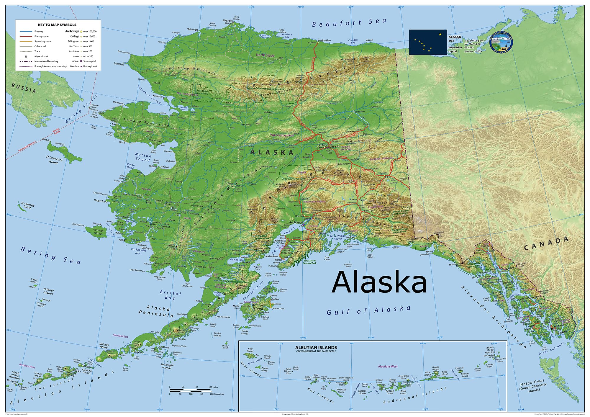
Alaska is a non-contiguous U.S. state located on the northwest edge of North America. It adjoins the Canadian province of British Columbia and the Yukon territory to the east, and shares a western maritime boundary in the Bering Strait with Russia's Chukotka Autonomous Okrug. This physical map of Alaska presents key information such as the capital cities, population, area size, and largest city, plus locations of airports, major highways, state boundaries, and populated areas. In addition, the map includes bodies of water and points of interest such as national and state parks, forests, cultural sites, and more. You'll have all the essential details to get around Alaska with confidence. It's a great tool for planning trips and exploring the vast area of Alaska. Size - 23.3 x 16.5 Inches. Printed onto high quality paper and finished with a gloss laminate. This physical map of Alaska presents key information such as the capital cities, population, area size, and largest city, plus locations of airports, major highways, state boundaries, and populated areas. In addition, the map includes bodies of water and points of interest such as national and state parks, forests, cultural sites, and more. You'll have all the essential details to get around Alaska with confidence. It's a great tool for planning trips and exploring the vast area of Alaska.