Cappadocia Map 2 of 4 (Nevsehir) Goreme, Urgup Uchisar, Zelve Hiking, Trekking & Walking Topographic Map Atlas Turkey Kapadokya Derinkuyu Underground
$14.95
by Sergio Mazitto
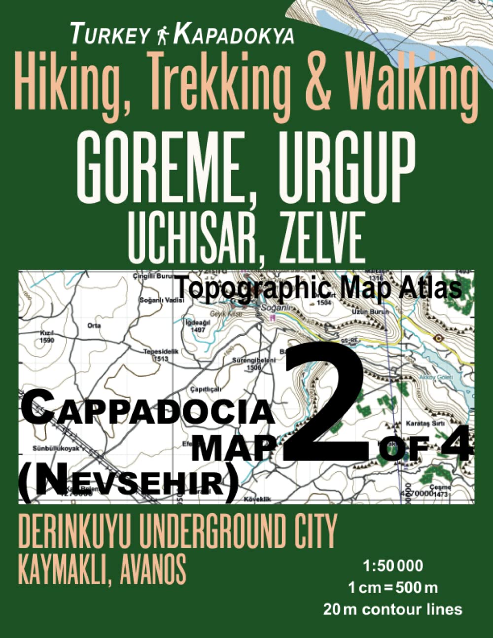
Large scale, highly detailed topographic map 1:50.000 for walking, hiking and trekking, printed as an atlas book (with overlapping pages). With the help of this topographic map atlas you can hike in the mountains and valleys of the historical region of Central Anatolia, now famous as the Cappadocia (Kapadokya) region of Turkey. This is a region of exceptional natural and cultural wonders, in particular interesting for its unique ‘fairy chimney’ rock formations (also known as hoodoos or earth pyramids) as well as the underground cities carved from the soft volcanic deposits of the area. This land is also famous for its early history monastic sites with many carved-from-rock churches and chapels, some having superb frescoes inside. All this makes the Cappadocia region one of the most visited and famous sites in central Turkey. This topographic map atlas covers the area to the east and south of the city of Nevsehir, including the area of Urgup with its famous Open Air Museum, Derinkuyu and Kaymakli underground city areas, Avanos, Uchisar, Zelve etc. This is Map 2 of the series of 4 maps, covering the surroundings of Aksaray, Nevsehir, Kayseri and Nigde respectively, together covering the whole area of the Cappadocia region most interesting to hikers, walkers and trekkers. 20 meter contour lines, road network, trails & paths, transportation, food, campsites, shelters, guest houses & hotels. Mercator projection with both UTM and WGS84 coordinate grids. The map scale of 1:50000 (1 cm = 500 meters) provides a wealth of detail while keeping low the weight of the atlas itself. The large page format of 8.5x11in minimizes page count and along with an overlapping map design allows for comfortable navigation. The details included in the topographic maps of this atlas were specifically selected to be useful for trekkers, hikers and walkers of all interests, and make it easy to plan and enjoy both short excursions and hikes as well as long multi-day adventures along the main marked routes and/or adjacent trails and paths, which are also shown on the maps. With this ultralight atlas you will always have a detailed, reliable, information-rich, battery-independent, shatter-proof map for your adventure.