Estero to Lemon Bay, FL - Laminated Nautical Navigation & Fishing Chart by Captain Segull's Nautical Sportfishing Charts | Chart # CHA39
$27.95
by Captain Segull's Sportfishing Chart
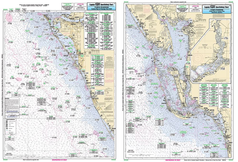
Laminated Fishing Chart Nearshore Fishing Chart: A nearshore chart 20 to 30 miles out. Side A from Clam Pass to Lemon Bay, including Port Charlotte Harbor and an inset of the Peace River. Side B, Lemon Bay to Passage Key Inlet Shows fishing areas, wrecks, reefs, local names and amenities in GPS out to the thousandths of a minute. 19.5" x 26.5"