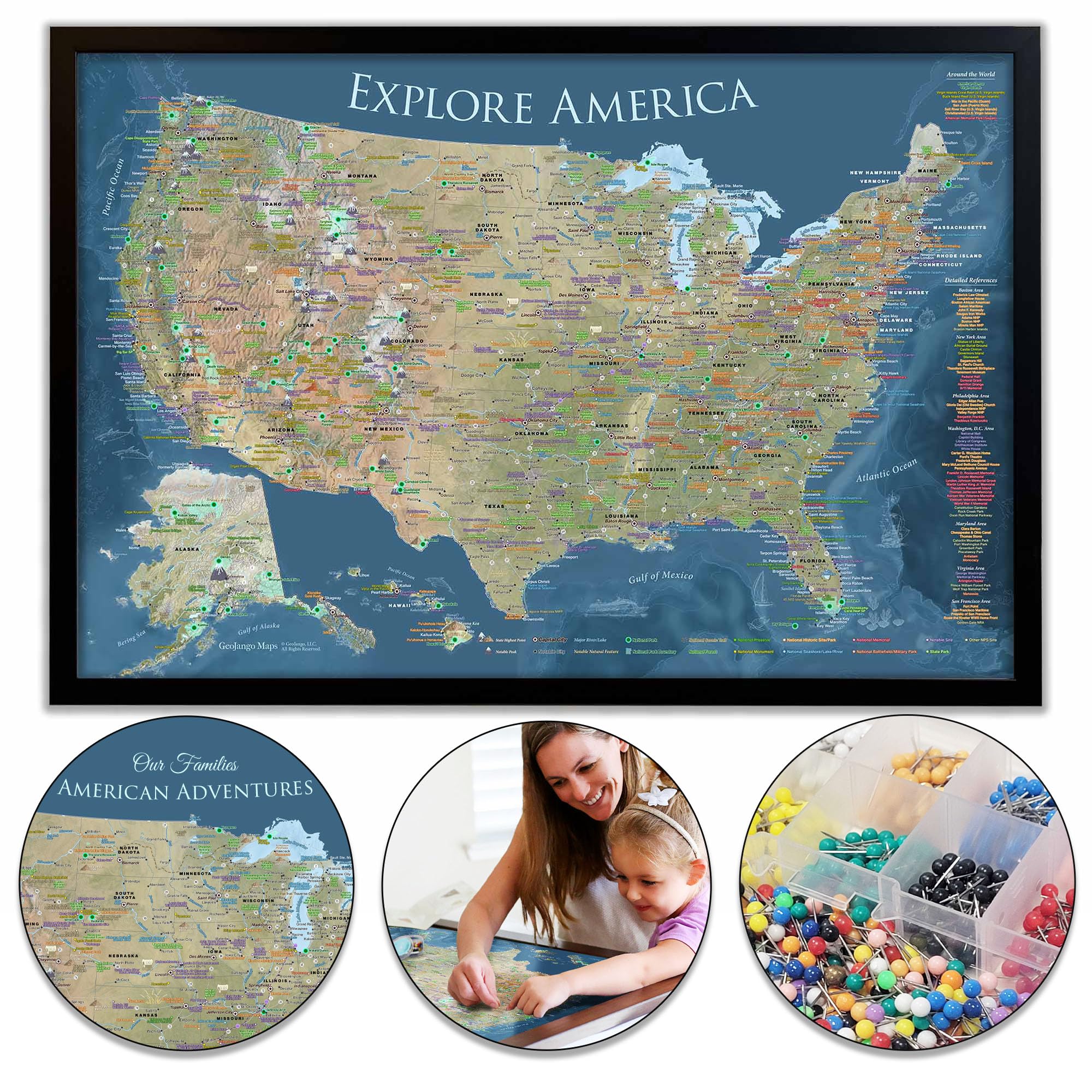
National Parks: Explore your map to find all 63 National Parks + and over 600 NPS Sites including National Monuments, Historic Sites, National Battlefields, National Wildlife Areas, and more. Explore fascinating destinations: Identifies locations of NASA Space Centers, State Capitals, and Historical Cities including Colonial Williamsburg, Mackinaw Island, Tombstone, Mount Vernon, the tallest elevation in every state, and features U.S. Interstates, and more! Current as 2025! Made in the United States: Fine Art production with archival inks and rich color depth. Professional Geography and created by an Environmental Scientist, located in Pleasanton, CA. 500 map pins included: A huge case of 500 map pins with 8 colors is included. The Framed Map and Stretched Canvas are mounted on a high-quality Pin Board and built to last for decades. Track your adventures across America. Perfect for travelers, hikers, campers, history, geography, travel, recreational vehicles, National Park Sites enthusiasts, and more! Includes United States Interstates for planning and referencing locations. Customize your map: Create a custom title. There are no limitations as we are good with designing just about anything on the map. Proofs are provided within 1 business day. Select “Customize & Add to Cart” to select your options for a custom title, quote, and/or legend. Select your fame and size too! The larger the map the better to see all of the details of the United States! Available Map Finishes: Rolled Poster with premium canvas, Framed Map printed on fine art satin paper, and Frameless Stretched Canvas. Available map sizes: 36x24" and 48x32" inches. Professional map projections: This map uses the Albers Continental Map projection - accurate for displaying the continental United States. We also use the proper Alaska North American Datum to accurately display the intricate shape of Alaska - note that Alaska is not flattened. The original Explore America map! Use this map to plan, track, and explore the geography and rich history of the USA! The smartest USA map: Geography is the essence of understanding how we are connected by culture, history, civilization, commerce, nature, and the environment. This map is filled with thousands of details about the USA and is designed to encourage further exploration. Use this map to locate: Over 600 National Park Service Sites (Including all 63 National Parks as of 2025) The tallest elevation in every state10 of the most climbed peaks in the U.S.A. Hike the National Scenic Trails that cross the U.S.A. Visit Space Centers & and much more. Includes a card about the map with a guide on how to get started Professional cartography: The map was created by a professional Geographer who thoroughly researched the amazing places across the USA! Thank you for your interest in our maps! Debbie Dennison, GISP, Geographer/Environmental Scientist.