After ratifying the Constitution in 1789, North Carolina became the twelfth state. North Carolina had seen its share of battles during the American Revolution, with the Battle of Cowan’s mill being a rather significant victory for the Patriots. British General Cornwallis had been pushed north from Charleston by South Carolina’s Colonial forces, and the British leader found himself facing General Greene in present-day Greensboro. Though the British held the land, their losses were critical, and the Continental Army eventually forced the British forces to the coast of Virginia. This last push would lead to the defeat of Cornwallis at Yorktown, which marked a turning point in the Revolution and guaranteed American victor and independence.
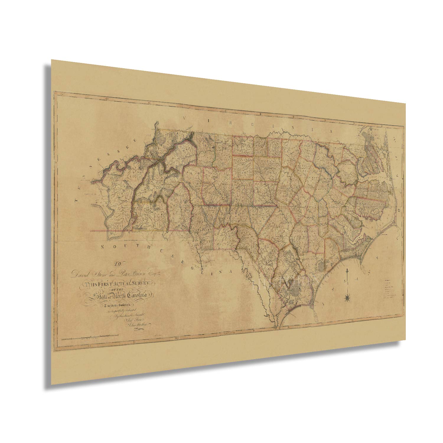
Produced in 1808, this is among the first detailed illustrations of the state and depicts counties, roads, churches, and other places of interest. These maps serve genealogists and historians to develop an idea of the legacies of the region and how they evolved, becoming what we recognize today. The distinctive aesthetic of this production transports the viewer back in time, and this is an authentic piece of cartographical history.
The early nineteenth century marked a period of significant growth for the state, and the population had reached more than half a million. While it remained mostly agrarian, the state did have cities expanding primarily in the Raleigh-Durham area. This transitional period in the newly independent United States set the stage for how the nation would evolve, and North Carolina’s rich history is deeply intertwined.
Our museum quality giclee North Carolina map wall decor print comes printed with archival ink on premium heavyweight matte paper. Shipped in a sturdy cardboard tube your NC wall art print will arrive ready to be framed. This eye-catching NC vintage map reproduction print makes the perfect gift for anyone that loves history and imagery.