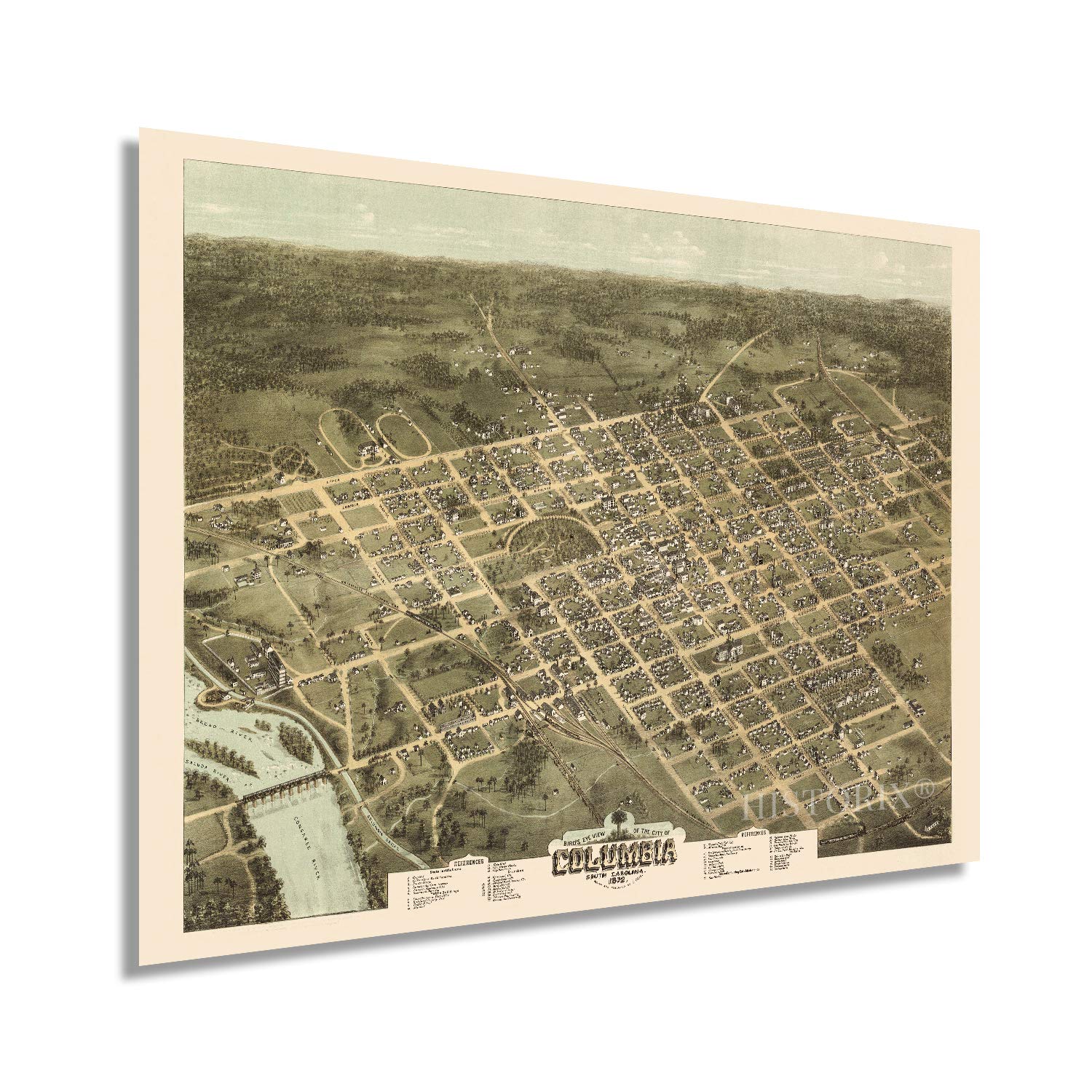
Produced and published by the prolific American cartographer C.N. Drie this unique depiction of South Carolina's State Capital shows it in a period of significant growth and transformation following the conclusion of the American Civil War. Much of Columbia had been burned in the last days of the conflict, and the rebuilding process was completed mainly by the publication of this map. Bird's eye perspectives were wildly popular during the late nineteenth century and would remain so until the 1920s. These unique illustrations bear a distinctive aesthetic and style that immediately transports the viewer back in time, creating an indelible link and connection to the past.
Columbia's rich history and geographic location at the confluence of the Saluda and Broad River allowed it greater access for goods to flow West and North. As the State Capital, Columbia is the center of politics for the State and has been since 1786. When the Santee Canal was completed in 1800, access to the thriving port in Charleston allowed the city to expand. This access attracted numerous immigrants from Western Europe, England, and Ireland. These immigrant communities established neighborhoods along cultural lines, many of which exist to this day.
Drie's illustrations are included in the Library of Congress, and his works are considered among the best of the era. The years following the end of the Civil War were pivotal to the development of Columbia's status in the South, and it became one of the most iconic Southern cities.
Our museum quality giclee print comes printed with archival ink on premium heavyweight matte paper. Shipped in a sturdy cardboard tube your print will arrive ready to be framed. This eye-catching vintage map reproduction print makes the perfect gift for anyone that loves history and imagery.