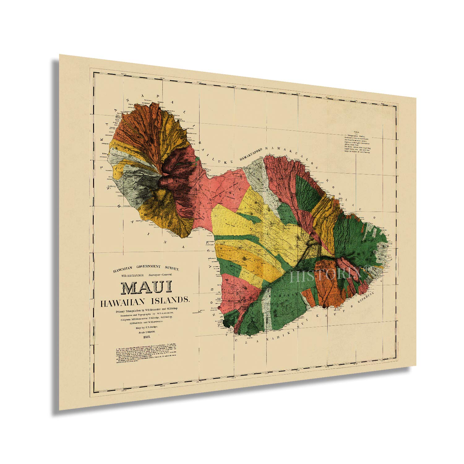
Produced by noted Hawaiian-born teacher, linguist, and cartographer William DeWitt Alexander one year after the formation of the Republic of Hawaii. This unique depiction of the second largest island shows it in a period of significant growth and transformation. The region had been producing sugar for the preceding two decades, and the local economy was growing exponentially with immigrants coming from Southeast Asia, Portugal, the United States, and Caribbean nations seeking agricultural employment. Missionaries had been coming to the island to establish churches throughout the islands, and DeWitt’s parents were among these groups. The island was annexed by the United States in 1898 and became a territory in 1900. The territory would not achieve statehood until 1959 and experienced a massive population boom during World War II.
This was the first map of Maui printed by the Hawaiian government and took contributor Frank Dodge nearly six years to compile DeWitt’s surveys. The distinctive style, close attention to detail, and accuracy of the rugged coastlines immediately transport the viewer back in time and creates an indelible bond between the past and present.
Prominent American mapmaker Julius Bien printed five hundred copies which were released in 1886. This map stands out due to the accuracy of the surveys used for the coastlines, which are iconic for their rugged landscapes and numerous valleys. Hawai’i has become one of the most recognized places in the United States, and tourism has been central to the economy during the nineteenth and twentieth centuries.
Our museum quality giclee print comes printed with archival ink on premium heavyweight matte paper. Shipped in a sturdy cardboard tube your print will arrive ready to be framed. This eye-catching vintage map reproduction print makes the perfect gift for anyone that loves history and imagery.