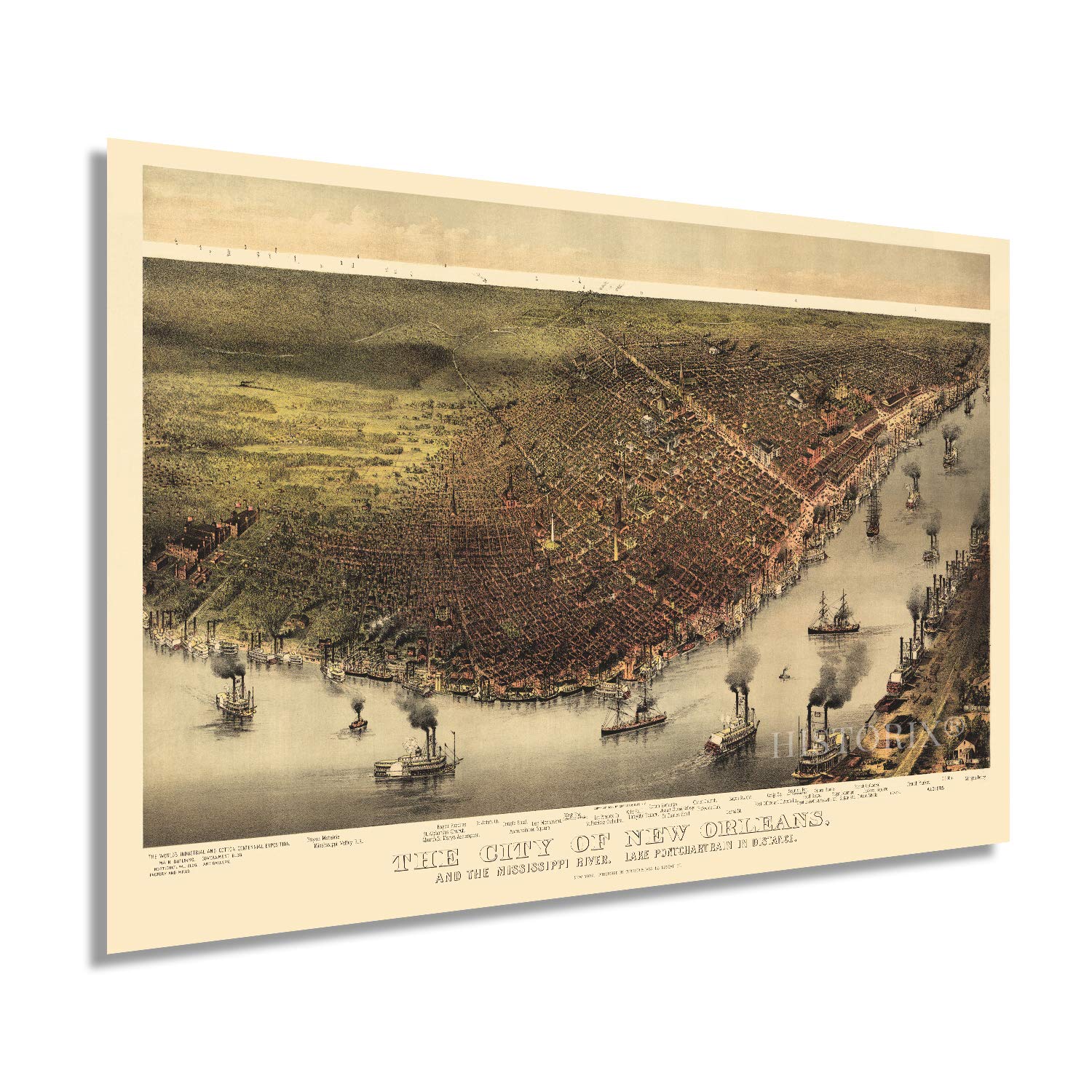
One of the most iconic American cities, New Orleans' rich history and unique geographic location shaped it into a widely diverse, prosperous, and critical part of the American West's founding. Initially founded in 1718 under French control, New Orleans's proximity to the Mississippi River made it one of the most strategic point for both military and trade as a route into the middle of North America. At the time of this map's publication, New Orleans had become a bustling, cosmopolitan city with a culture distinctly its own. The Union's capture of the port two decades prior in the Civil War marked a turning point in the war allowing the Union to control the flow of goods and munitions and effectively cut off Confederate supplies from entering the region.
Produced by the prolific New York based printmaking company, Currier and Ives, this bird's eye perspective bears a unique aesthetic and distinguished characteristic that immediately transports the viewer back in time, creating an indelible bond between the past and present. These perspectives were produced as marketing materials to entice industrialists and workers alike. Local merchants and residents would also display them in a show of civic pride. Because they weren't required to contain technical information, they were produced with greater artistic detail and embellishment.
Because New Orleans had been occupied by Union forces early in the Civil War, it was sparred much of the damage the rest of the American South endured. The preservation of the cities iconic architecture allowed it to thrive to this day.
Our museum quality giclee print comes printed with archival ink on premium heavyweight matte paper. Shipped in a sturdy cardboard tube your print will arrive ready to be framed. This eye-catching vintage map reproduction print makes the perfect gift for anyone that loves history and imagery.