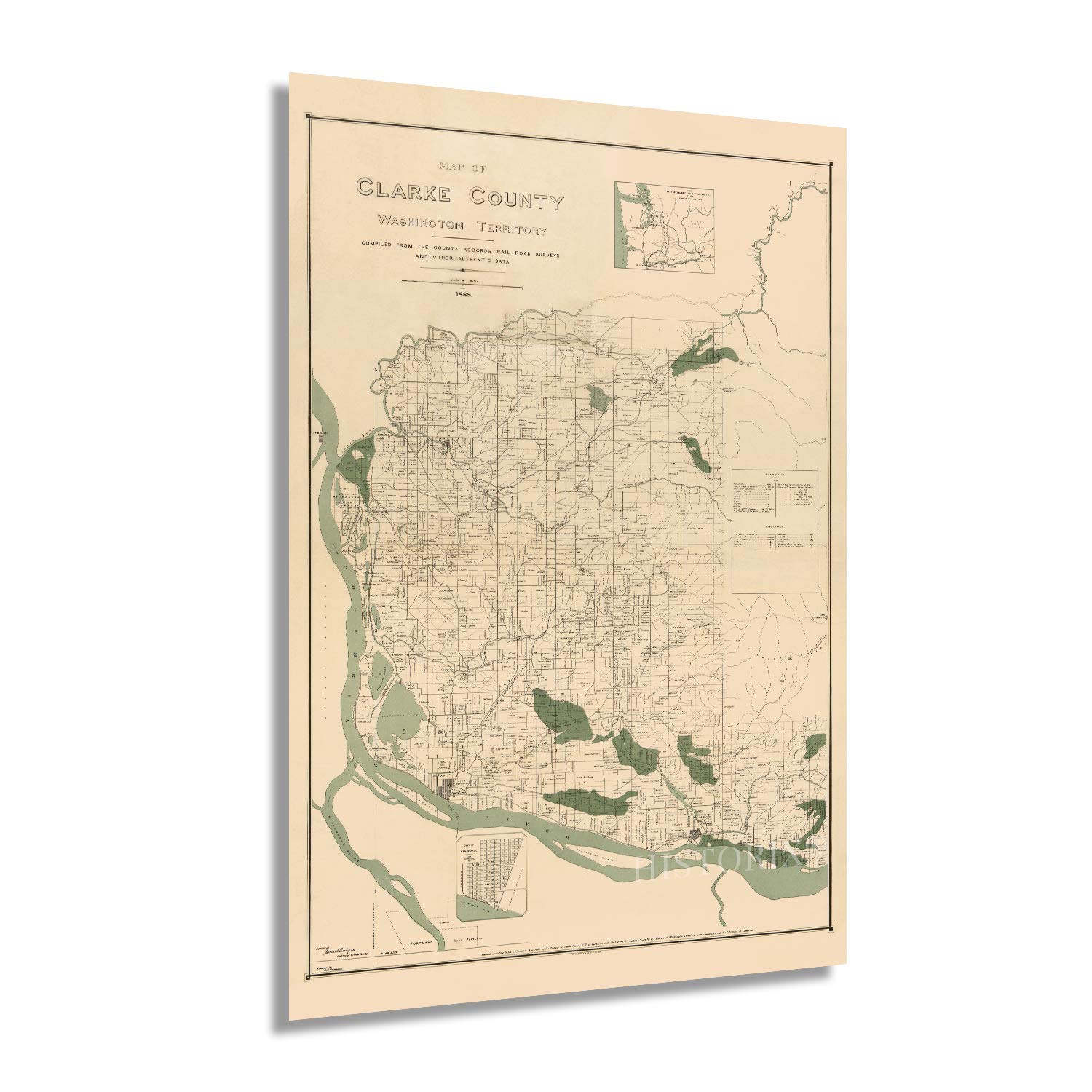
Produced and engraved by prominent German-born lithographer Julius Bien this detailed depiction of the southernmost County in Washington state shows it in a period of significant growth and transformation. Bien would later become president of the American Lithographer's Society and is considered one of the most prominent cartographers of the nineteenth century. Bien's maps employed early chromo-lithographic methods, and he gained attention from the United States Government, who hired him to produce numerous maps throughout the nineteenth and twentieth centuries.
Named after William Clark of the Lewis and Clark Expedition, Clark County Washington sits across the Columbia River from Portland, OR, and was established in 1845. Its early economy centered on a thriving lumber industry and ship timber to shipbuilders in Seattle, San Francisco, and Massachusetts. Vancouver, the largest city in the County, is considered the largest suburb of Portland and was incorporated in 1857. Formed initially around Fort Vancouver in 1824, it was the first establishment in the Washington Territory. Immigrants from Ireland and Western Europe created neighborhoods and communities in the city and region based around cultural lines, many of which still exist today.
Bien's map's unique aesthetic and distinctive style immediately transport the viewer back in time, creating an indelible link between the past and present. By the late nineteenth century, Clark County had become a leading cultural and industrial center for the Pacific Northwest. Railroad expansion in the 1870s had opened up access to the region and thriving ports in both Portland and Vancouver.
Our museum quality giclee print comes printed with archival ink on premium heavyweight matte paper. This eye-catching vintage map reproduction print makes the perfect gift for anyone that loves history and imagery.