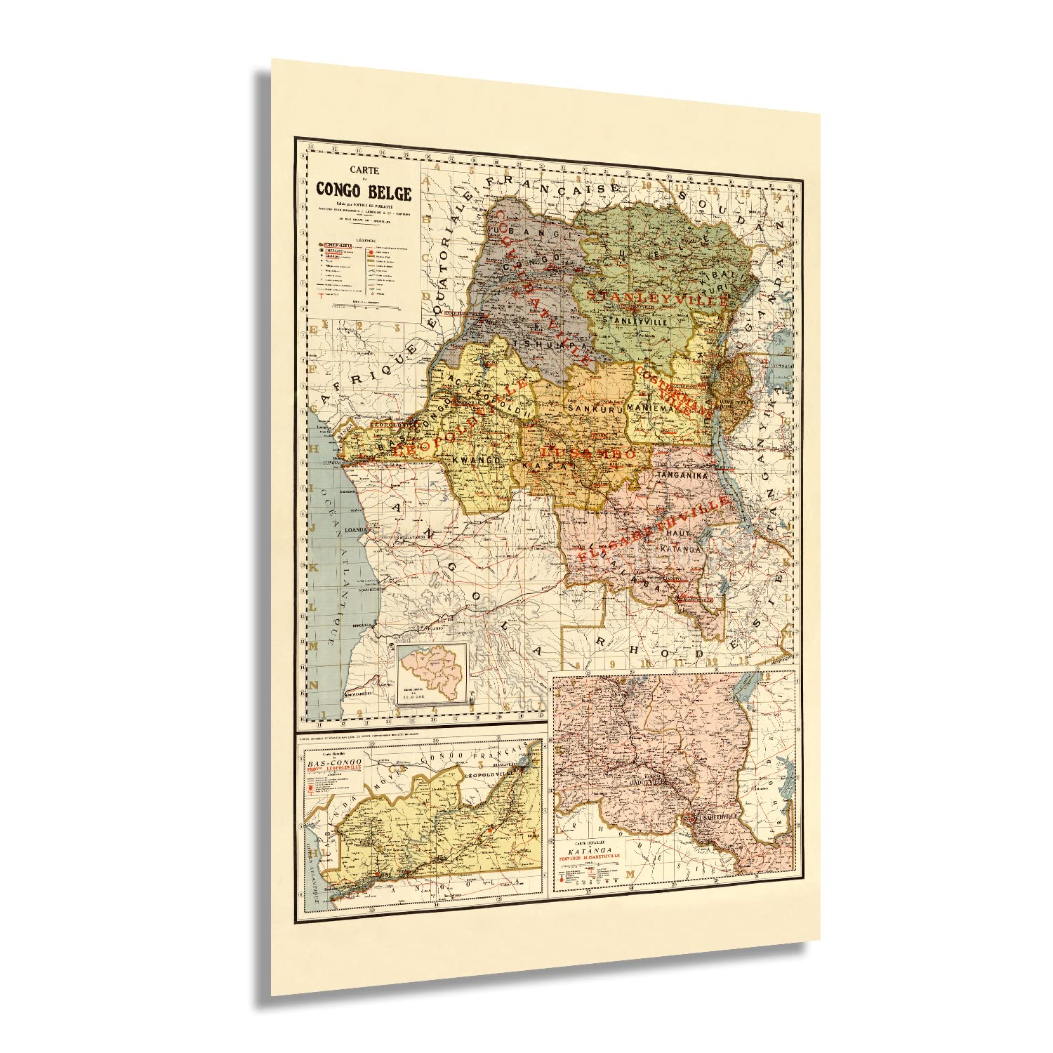
The Congo was a Belgian colony from the early 1870s until it achieved independence in 1960, though when this map was published, the region was considered personal property of Belgian King Leopold. Little is known of Leon de Moor, the cartographer who produced this depiction, but J. Lebègue and Co was a prolific publishing house that produced numerous travel accounts, maps, and other geographical documents to distribute throughout Western Europe. The detailed insets provide even more insight into the development of the region in the late nineteenth century. During this time, the primary economic driver was the production of rubber as automobile tires increased demand for vulcanized rubber throughout North America and Europe.
Advances in infrastructure, including the construction of a railway from the capital to the coast, increased access and expansion throughout the region. Western Africa was experiencing significant transformation during the late nineteenth century, and The Congo was no different. The upper portion of the Congo River was navigable by steamboat and allowed a flourishing import and export trade. This map bears a unique aesthetic that immediately transports the viewer back in time, creating an indelible bond between the past and present.
The 1890s were a period of rapid transformation in Africa and across the globe as advances in technology allowed for modern improvements such as electric light, faster transportation, refrigeration, and sanitation. This is an authentic piece of African and European cartographical history that illustrates the rich history of The Congo as it neared the turn of the century.
Our museum quality giclee print comes printed with archival ink on premium heavyweight matte paper. Shipped in a sturdy cardboard tube your print will arrive ready to be framed. This eye-catching vintage map reproduction print makes the perfect gift for anyone that loves history and imagery.