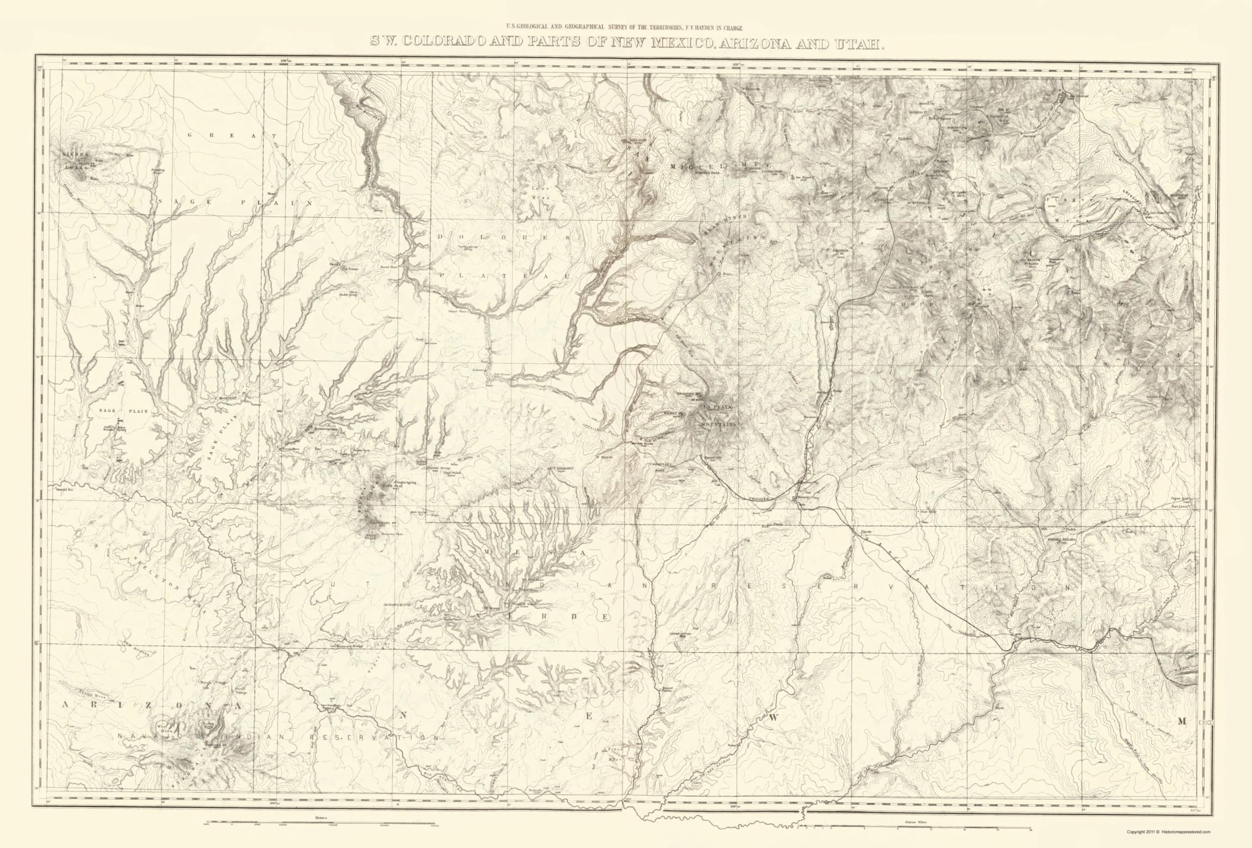
MAPS OF THE PAST Topographical Map - Colorado Southwest New Mexico - USGS 1881-23 x 33.98 - Vintage Wall Art
$36.95
by MAPS OF THE PAST
OWN A HISTORICAL TOPOGRAPHICAL MAP TODAY - Topographical maps provide you a birds-eye view of how the topography of certain pieces of land are mapped out. See how much today's maps have changed from centuries ago. See how waterways have shifted, or how forrests have become thralling cities. See how history has changed the landscape with a topographical map today! TOPOGRAPHICAL MAPS PROVIDE IMPORTANT INFORMATION -Topographical maps show you how the borders of a county are established and were they can be found. It also highlights rivers, mountains, and other natural elements, and it will show you where the cities are located within it. ONLY ACCEPT THE BEST PRINT QUALITY FOR YOUR REPRODUCTIONS - There are many printers and print types available on the market, when purchasing a reproduction there is no finer quality reproduction than a reproduction using the Giclee Printing method. Giclee describes the technique or style of printing used, and it is revered as the highest quality printing because of the way it precisely sprays ink onto a surface. Trust nothing less than the best! GUARNANTEED TO GET EXACTLY WHAT YOU ORDERED - This map comes exactly to the specification of 23.00 x 33.98 inches/58.42 X 86.30 cm. All of our maps come rolled, wrapped, and shipped in a heavy gauge mailing tube to ensure it arrives intact. WHY CHOOSE MAPS OF THE PAST? - Maps of the Past is one of the single largest producers of different types of maps. They legally own the rights to the maps they sell, and provide them to you in clean, clear, and vibrant print. If you are looking for a high quality map print, then look no further than Maps of the Past! Sites/facts specific to this historic topographic map are:
the Denver and Rio Grande R.R., Rio Dolores, San Miguel River, Bear River, Rio Mancos, Rio de los Pinos, Rio Nutria, Rio San Juan, Rio Piedra, Disappointment Creek, Bear Creek, Clear Creek, Huerto Creek, Mount Elmo Creek, Hovenweep Creek, Bernoso Creek, Alborola Creek, Sierra Abajo, San Miguel Mountains, San Juan Mountains, Bear River Mountains, La Plata Mountains, Mount Sneffels, Mount Wilson, Gala Mountain, Mount Kendall, Mount Canby, Red Mountain, Mount Oso, Mount Foles, Engineer Mountain, Abajo Peak, Dolores Peak, Lizards Peak, Mineral Peak, Randies Peak, Bristol Peak, Pigeons Peak, Helmet Peak, Hesperis Peak, Pagosa Peak, Dolores Canyon, Great Sage Plains, Lone Mesa, Finger Mesa, Skeleton Mesa, San Miguel Lake, Rio Grande Pyramid, Dolores Plateau, Yellow Jacket Spring, Ruins, Burial Place, Thompson's Park, Hot Springs, Piedra Parada, Cinder Buttes, Double Walled Tower, Great Cliff House, Two Story House, Mosses Tower, Jackson's Butte and many other landmarks of interest.
The following towns are featured:
San Miguel, Ophir, Burrow Park, Eureka, Silverton, Sherman, Rico, Dolores, Mances, Parrott City, Durango, Animas City, Hermoso, Fort Lewis, Pagosa Springs, Pine River and many others.
This antique map reproduction is situated in:
Colorado and New Mexico (CO/NM)