National Geographic Arizona Wall Map (33 x 40.5 in) (National Geographic Reference Map)
$24.95
by National Geographic Maps
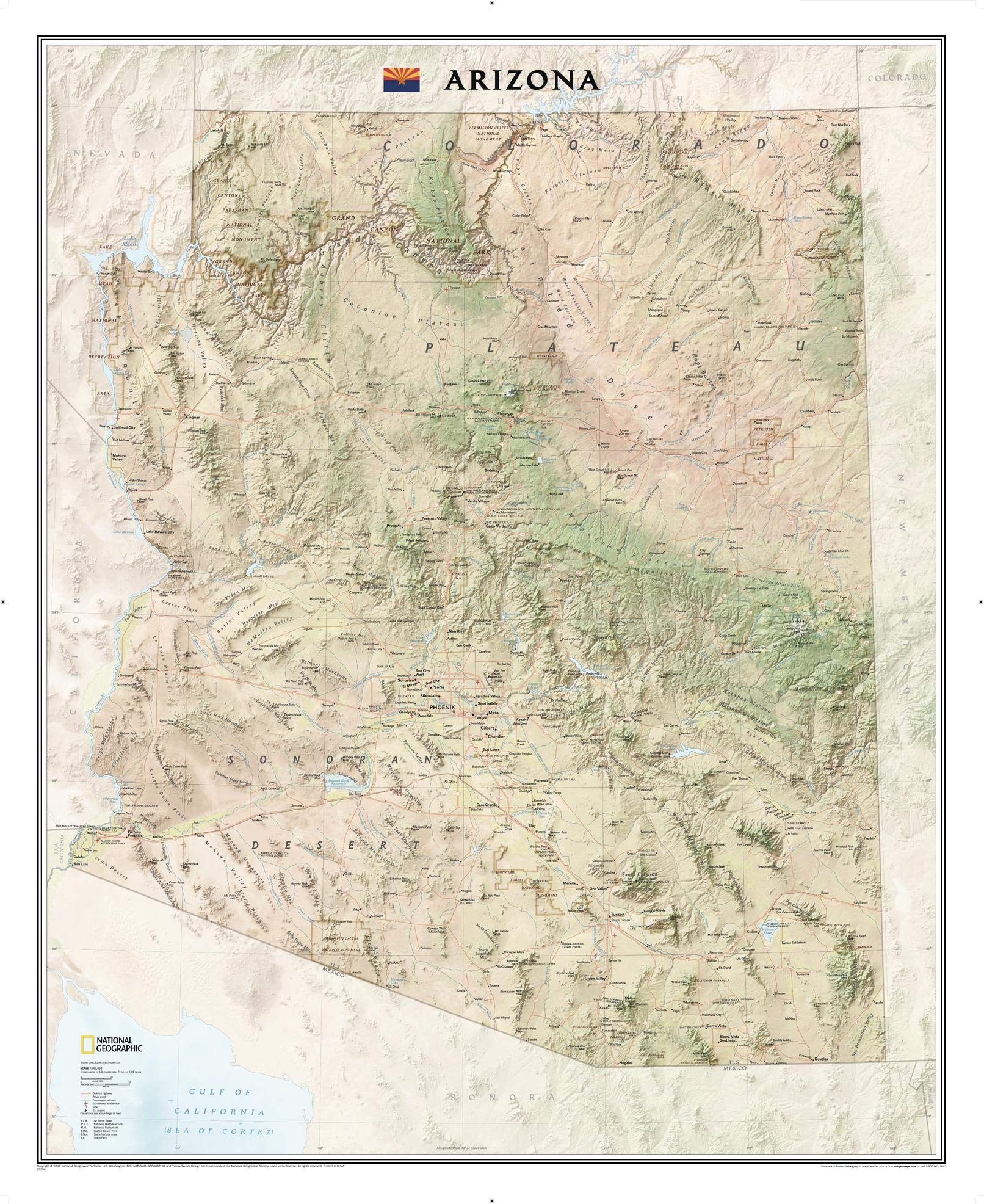
National Geographic's wall map of Arizona is part of a growing series of State Wall Maps. From the Grand Canyon to the Sonoran Desert, the state is rendered in dramatic detail. Stunning shaded relief and vibrant colorization depicts mountain ranges, forests, deserts, canyons, and other physical topography. Prominent peaks, major lakes, rivers, and reservoirs, and other geographic features are highlighted. In addition to hundreds of place names, this map includes the locations of cities, major roadways and railways, airports, military bases, ski resorts, national and state parks, and recreation areas. This expertly designed map makes an attractive addition to any office or study. The map is packaged in a two inch diameter tube with a label showing a thumbnail of the map with dimensions and other pertinent information. Map Scale = 1:766,000 - Sheet Size = 33" x 40.5" Founded in 1915 as the Cartographic Group, the first division of National Geographic, National Geographic Maps has been responsible for illustrating the world around us through the art and science of mapmaking.Today, National Geographic Maps continues this mission by creating the world's best wall maps, recreation maps, atlases, and globes which inspire people to care about and explore their world.