National Geographic Washington Wall Map (40.5 x 30.25 in) (National Geographic Reference Map)
$24.95
by National Geographic Maps
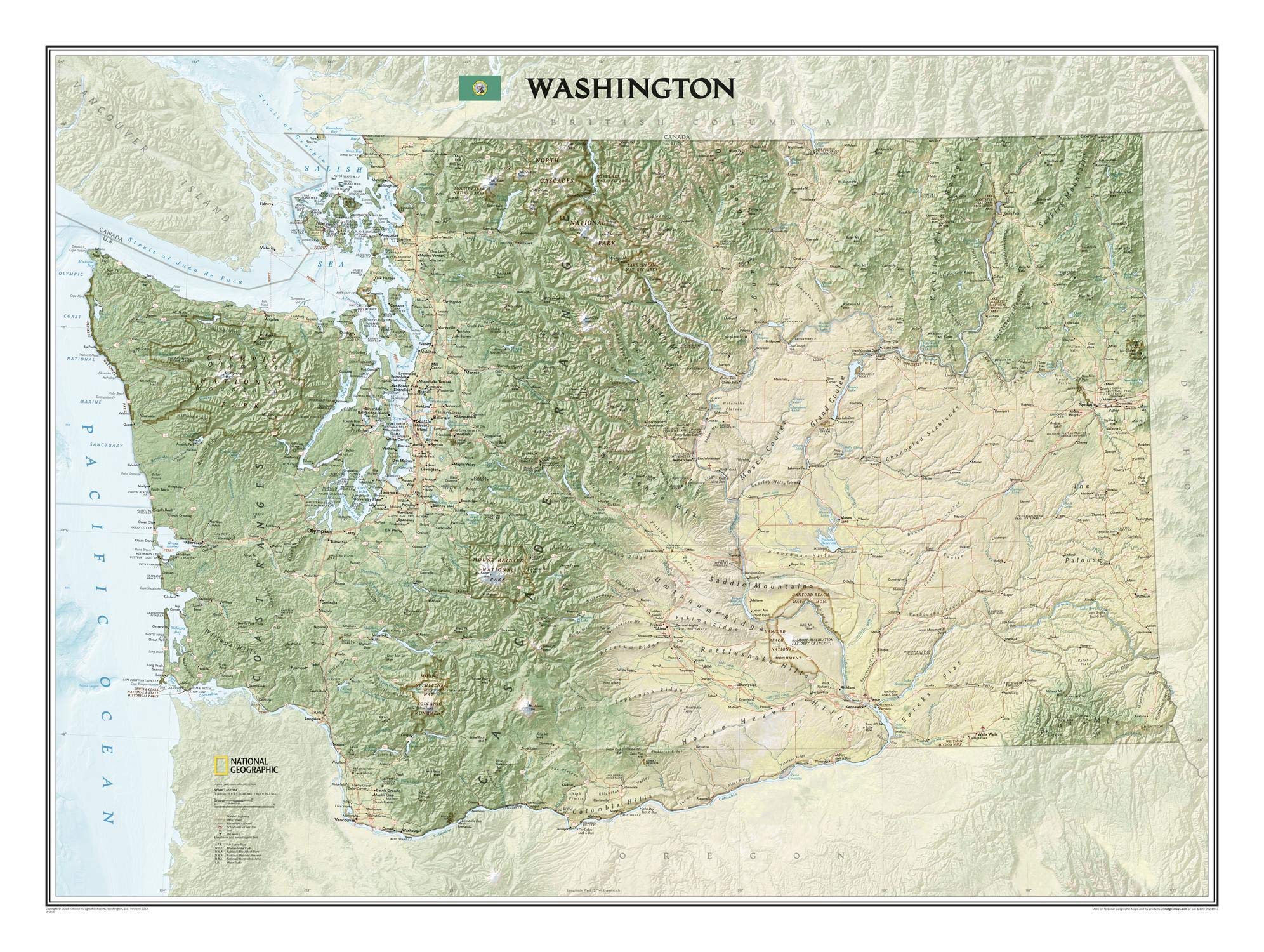
Explore the forested islands of Puget Sound, the snow-capped Cascades, and the agricultural basins fed by the Columbia and Snake rivers with National Geographic's wall map of Washington. Part of the growing series of State Wall Maps, this map offers a dramatic visualization of the Evergreen State's physical geography. Stunning shaded relief and vibrant colorization depicts mountain ranges, forests, valleys, and other physical topography. In addition to the geographical features such as mountain ranges, prominent peaks, islands, major lakes, rivers, and reservoirs, this map includes the location of cities, towns, airports, national and state parks, and military bases. The Pacific Crest Trail, a long-distance hiking and equestrian trail to runs through the entire state from the border with Canada into Oregon, is shown as well. The map is packaged in a two inch diameter tube with a label showing a thumbnail of the map with dimensions and other pertinent information. Map Scale = 1:652,387 - Sheet Size = 40.5" x 30.25" Founded in 1915 as the Cartographic Group, the first division of National Geographic, National Geographic Maps has been responsible for illustrating the world around us through the art and science of mapmaking.Today, National Geographic Maps continues this mission by creating the world's best wall maps, recreation maps, atlases, and globes which inspire people to care about and explore their world.