National Geographic: Britain and Ireland Executive Wall Map - Antique Style - 23.5 x 30.25 inches - Art Quality Print
by National Geographic
Decorate your office or home with this classy National Geographic product. This Britain and Ireland map is a prestigious product due to its high calibre cartographic production and choice of antique style. Perfect for your home to plan your dream holiday. For businesses, use this to showcase where your customers, suppliers and offices are located across the british isles.
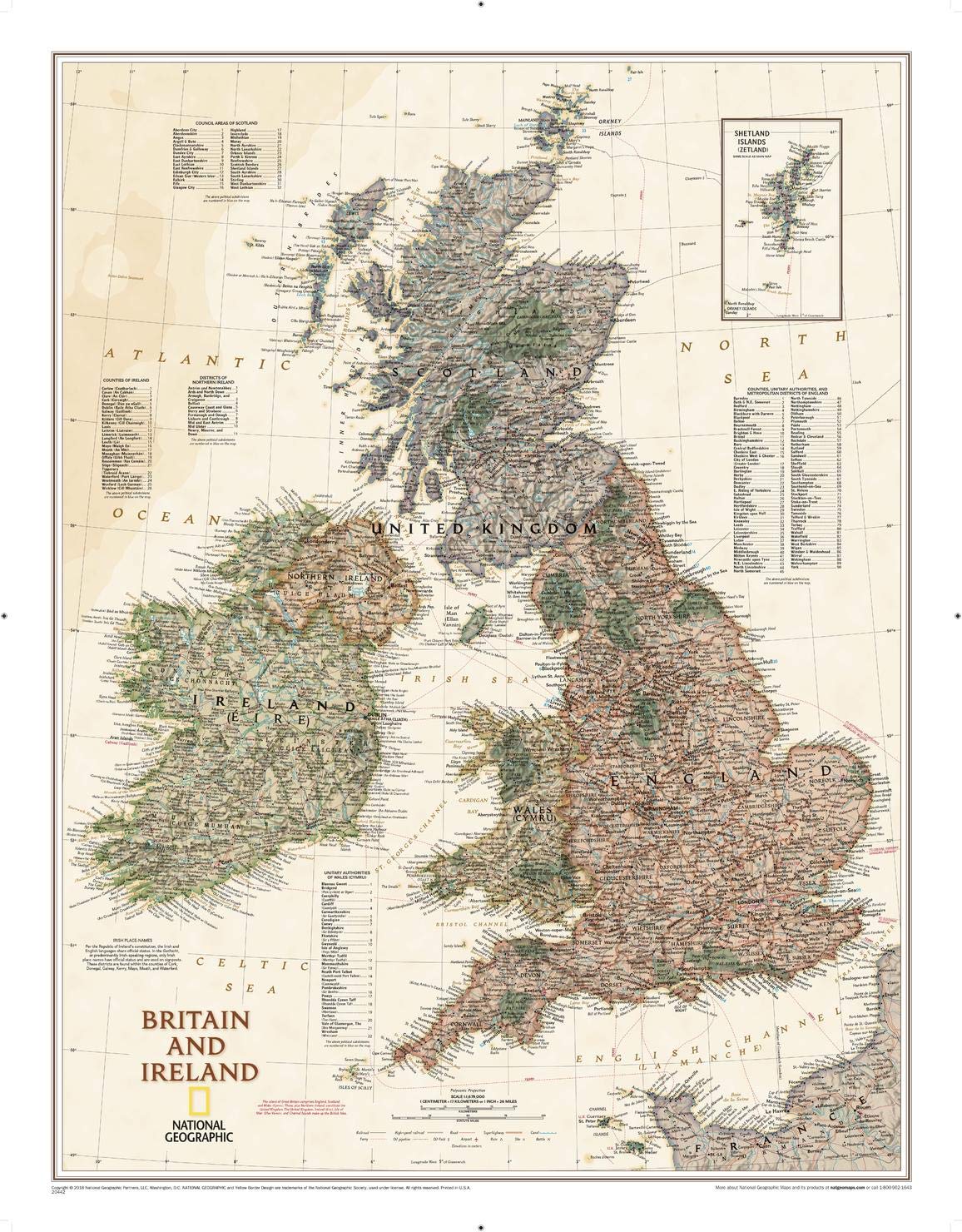
This Britain and Ireland map of political and physical features can fit in any space. Showcasing the continent in stunning detail with state-of-the-art cartographic techniques delivering accuracy and exceptional quality, the innovative and engaging design makes the content easily accessible and user-friendly.
This map uses a rich, easy to read color palette featuring muted oceans and stunning shaded relief that has been featured on National Geographic wall maps for over 75 years. It is drawn in a Polyconic projection, where the parallels are all non-concentric circular arcs. An inset of the Shetland Islands and details on the counties, districts and boroughs of both Britain and Ireland add details to this classic map.
National Geographic's maps are the standard by which all other reference maps are measured. The maps are meticulously researched and adhere to National Geographic's convention of making independent, apolitical decisions based on extensive research using multiple authoritative sources.
Printed on polypropylene, an ideal material for wall maps as the printing brings out rich colours, and crisp edges for readability. The material is stronger than most papers and unlikely to crease or rip. The matte finish eliminates glare, and adds texture to the map. Ideal for display.
Your map is rolled and packaged in a sturdy tube to protect it during shipment.