National Geographic: Yellowstone National Park Wall Map - 24 x 36 inches - Laminated
by National Geographic
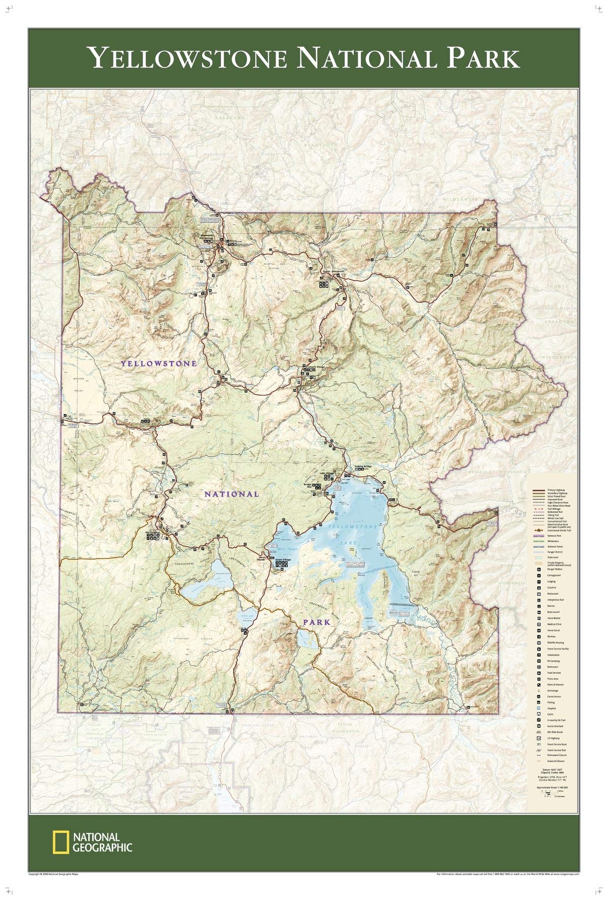
Tthis Yellowstone National Park map is an invaluable resource for exploring over 1,000 miles of mapped trails within the park. Based on the popular Trails Illustrated map of the area, this wall map provides rich topographic detail to show the magnificent scenery of America's first national park, including key points of interest such as Mammoth Hot Springs, Canyon VIllage, Yellowstone Lake, and more.
Explore the park with historic details, roads, trails, regions of National Parks, National Forests, Wilderness Areas, State Forests, and the intersection of the Continental Divide Trail. Points of interest including ranger stations, interpretive trails, picnic areas, horse rental areas, and more are featured on this highly attractive map.
This map is part of a series of maps based on the Trails Illustrated map series of national parks, specially designed to be informative and attractive for wall displays. It makes a wonderful companion to others in the series, including Glacier & Waterton Lakes Park and Zion National Park.
Your laminated map has a glossy finish so that you can use dry erase markers on the map to highlight features, make plans, and share unique information with others. Lamination is also extremely durable, resistant to folding or ripping.
Your map is rolled and packaged in a sturdy tube to protect it during shipment.