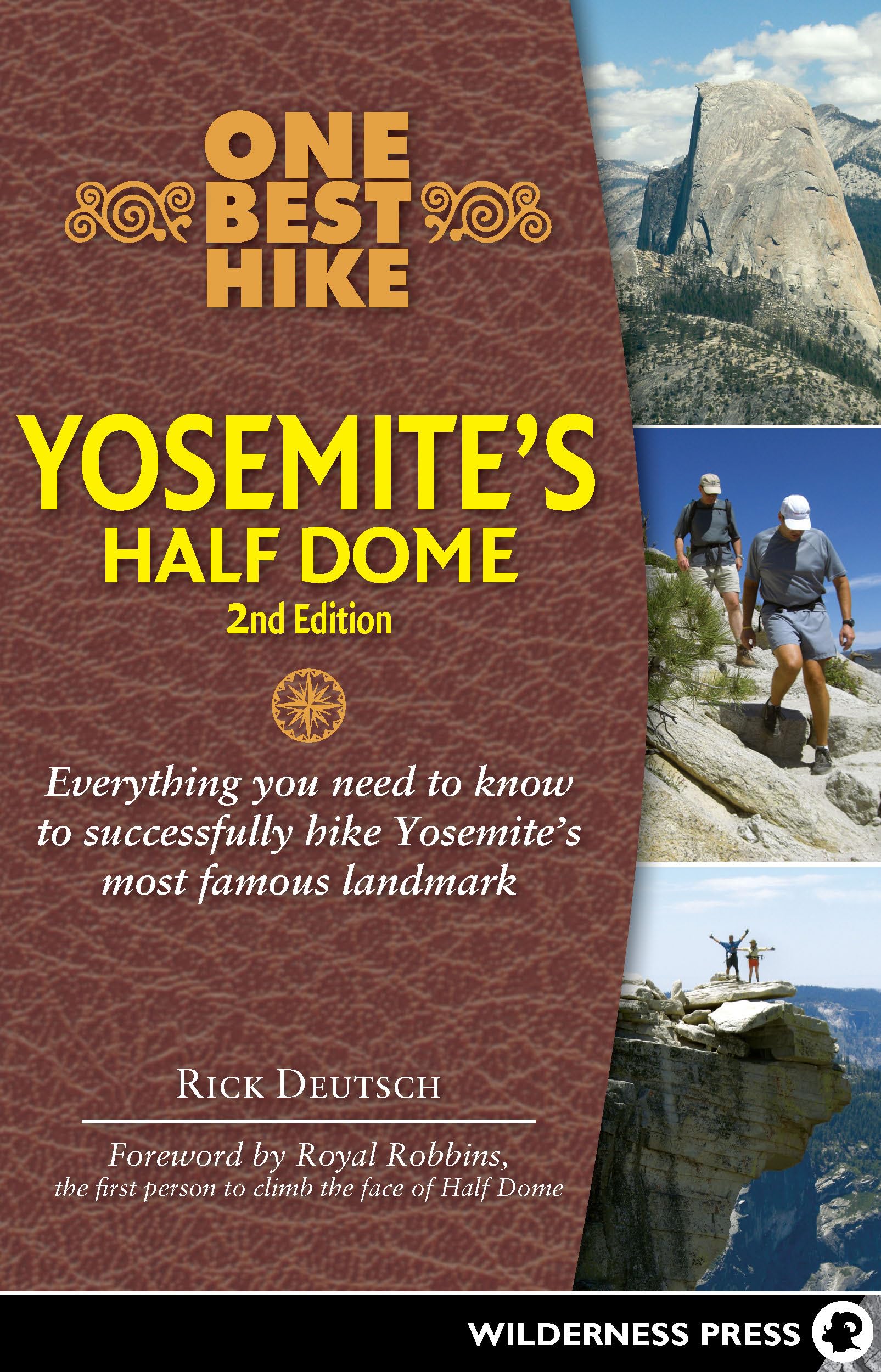
Successfully hike Yosemite’s most famous landmark with the guide that helps you prepare and provides the details you need to know. Getting to the top of Yosemite National Park’s Half Dome in California is one of America’s epic day hikes. Starting in Yosemite Valley, you’ll ascend nearly one vertical mile past two impressive waterfalls, through fragrant pine, fir, and cedar forests, then 425 feet up sheer granite on the famed steel cables to the summit, where you’ll enjoy some of the grandest views of your life. If you do it right, you’ll be back down in the valley, celebrating your accomplishment, later that evening. While tremendously rewarding, this hike is also one of the park’s most strenuous. Here’s everything you need to know to successfully make the 15-plus-mile trek. This step-by-step guidebook by Rick Deutsch tells you exactly how to hit the trail with confidence. Inside you’ll find: Detailed, specific advice on the proper physical conditioning - Trail-tested list of what to wear and bring on the hike - Historical vignettes and 18 key points of interest along the trail, with GPS markers - More than 100 photos so you know what to expect One Best Hike: Yosemite’s Half Dome , with its can-do approach, nuts-and-bolts advice, and practical tips, will leave you wondering why you’ve waited so long to embark on this truly special hiking adventure. "This guide covers everything you could possibly need or want to know about Half Dome and how to plan a successful hike." --Merced Sun-Star, May 2012 "This book is worth purchasing and it's an easy read. Being prepared and knowing some history will make your hiking Half Dome all the more memorable." --SeeYosemite.com, April 2012 This is a bona-fide "Bucket List" item for all adventure-minded people. This will be one of the hardest things you ever do - It's a goal and a journey. Carpe Diem! Seize the Day. Rick Deutsch has lived the Carpe Diem lifestyle, enjoying adventure travel worldwide. He's hiked in many rewarding places including the Galapagos, Machu Picchu, the Great Wall of China, Mt. Fuji and the Pyramids. Some of Rick's other "personal bests" include summiting California's Mount Whitney, hiking Mount Shasta, rafting through the Grand Canyon, bicycling the 500-mile Iowa cross-state bike tour, mountain biking in Utah, dog sledding in Alaska, and over 250 scuba dives in such exotic locales as the Caribbean, Papua New Guinea, Palau and Truk Lagoon. His proudest achievement is his 41 hikes up to the top Half Dome, the granite monolith symbol of Yosemite National Park. He's written the best selling book, 1st edition of "One Best Hike: Yosemite's Half Dome." Rick gives motivational speeches and lectures on hiking at museums, libraries, colleges, outfitters, cruise ships and to civic groups. See RickDeutsch.com POI 2: Vernal Fall Bridge Elapsed time: 30 minutes - Altitude: 4,409 feet - Cumulative Distance: 1 mile - GPS Coordinates: N 37 43.565 W 119 33.094 As you walk up the paved path you will get some good ups and downs to warm up. To your left you will a see large rockfall that at one time was the site of a trail to Sierra Point. It has long been closed and is not recommended for use. Rattlesnakes abound here, and it is pretty rough scrambling. Sierra Point was the one spot where you could see four waterfalls from a single vantage point: Vernal Fall, Nevada Fall, Yosemite Falls, and Illilouette Fall. Grizzly Peak lies just above you and to the left. You can easily see and hear the roaring Merced River to your right. As you continue, the view to the right will open up and you may catch a glimpse of Illilouette Fall streaming down in the distance. All the falls at Yosemite are fed by snowmelt and are virtually gone by late August, depending on the previous year’s snowpack. Once you arrive at the wooden footbridge, you can look up and to the left to see the waterfall framed by trees. An emergency telephone is nearby. A sink and water fountain provide the final opportunity to fill your bottles with potable water. For the rest of the hike, you’ll need to treat the water. Also, the restroom building at the right, opened in the 1930s, will provide your last chance to use a flushing, porcelain toilet. There are no trash cans, so please pack your waste. A couple hundred yards up the Mist Trail, you will arrive at a control gate. It is closed during the winter, when the steps ahead might be covered with ice. A junction here allows you to continue on the Mist Trail or go right onto the JMT. Regardless of which way you proceed at the control gate, look to your hard right, and just a few yards up the JMT you will see a large granite rock to the left of the trail. It is called Register Rock. In the early days before the government organized things, people built trails in the rough terrain and charged tolls to use them. For a period in the 1860s hikers signed or “registered” on the rock and paid a toll to use the trail to get to Glacier Point and Nevada F