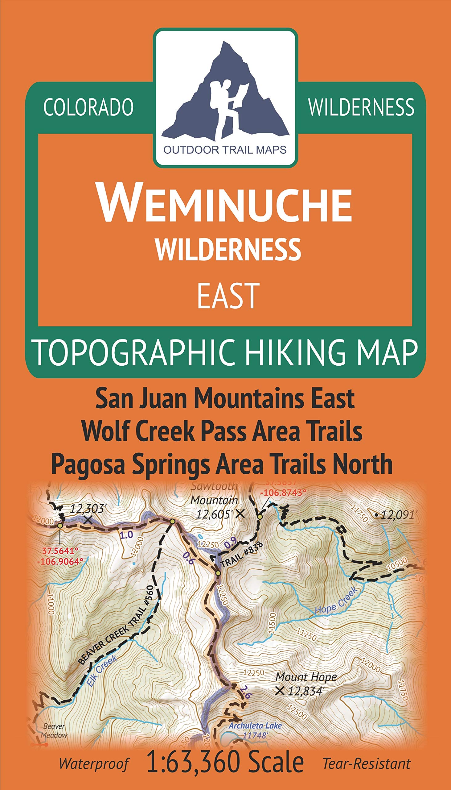
Outdoor Trail Maps Weminuche Wilderness East - Colorado Topographic Hiking Map (2019)
$8.95
by Outdoor Trail Maps
Waterproof, tear-resistant, 1:63,360 scale with a compact 4"x7" folded size for your pocket Smaller and lighter - no more unfurling huge maps - designed for on-trail use Segment distances - mileage - for all trails Up-to-date for 2019 with accurate trail routings and distances GPS coordinates for trailheads and trail junctions - device compatible Waterproof, tear-resistant topographic hiking map covering all of the hiking trails in eastern portion of the Weminuche Wilderness area of Colorado west of Wolf Creek Pass, north of Poncha Springs and south of Creede and Lake City. The front side of the map covers trails in the heart of the wilderness north of the Piedra River. The back of the map shows the very eastern portion of the wilderness near Wolf Creek Pass and Poncha Springs. This map contains a long stretch of the Continental Divide Trail. See the separate Weminuche Wilderness WEST Map by Outdoor Trail Maps LLC for coverage of the western portion of the wilderness.