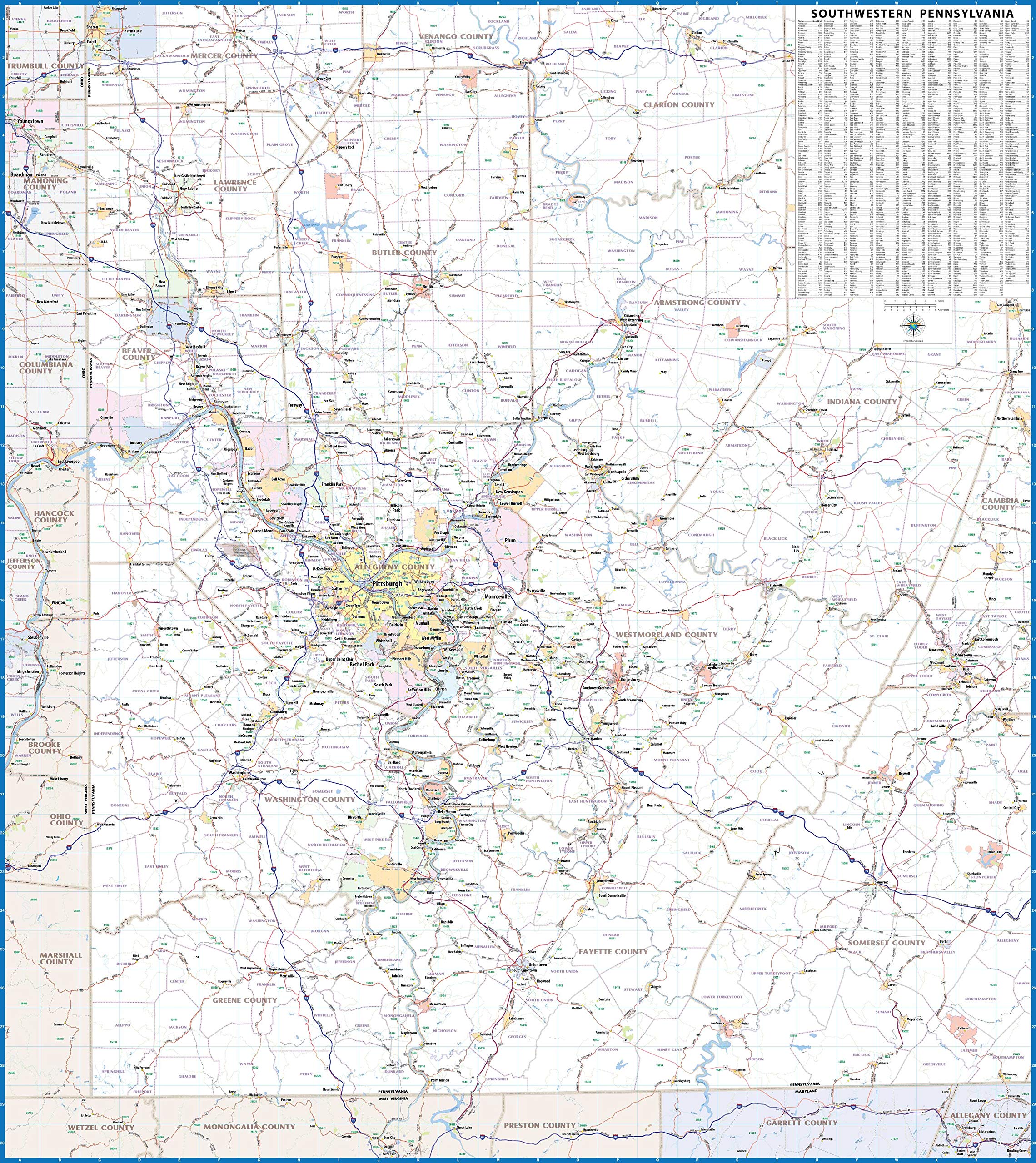
Pittsburgh and Southwest PA Laminated Wall Map (42” Wide by 47” high)
$220.00
by CartoTerra
Laminated Major Roads and Highways (Does not show every street/road) Laminated wall map of the Pittsburgh Metro Area showing locations within 35 - 60 miles of downtown Pittsburgh, including all of southwestern Pennsylvania. The map covers Allegheny, Lawrence, Butler, Armstrong, Indiana, Westmoreland, Fayette, Washington, Greene, and Butler Counties, as well as the immediate adjacent areas of Pennsylvania, West Virginia, Ohio, and Maryland. Features shown include cities, towns, major roads and highways, and zip codes. An index of community names is included. The laminated map is rolled and shipped in a tube.