Rail-Trails Mid-Atlantic: The Definitive Guide to Multiuse Trails in Delaware, Maryland, Virginia, Washington, D.C., and West Virginia
$14.19
by Rails-to-Trails Conservancy
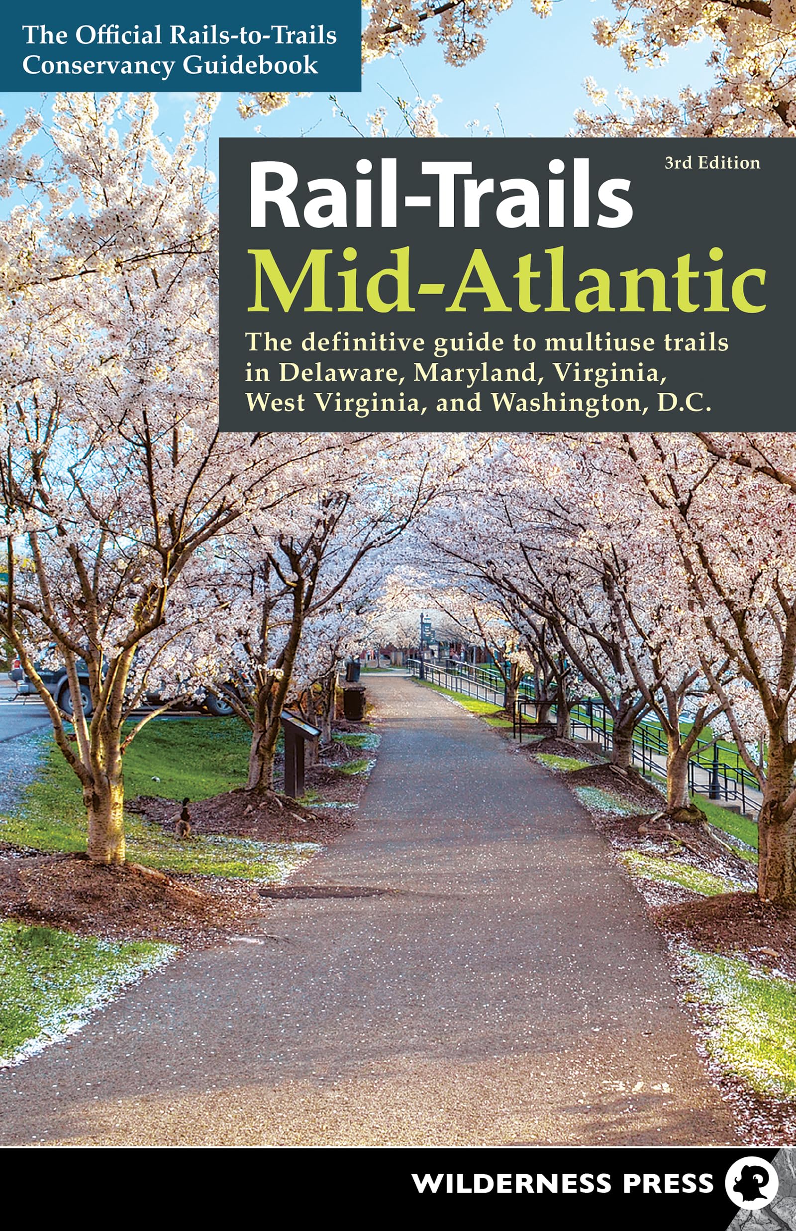
Explore 57 of the best rail-trails and other multiuse pathways in Delaware, Maryland, Virginia, Washington, D.C., and West Virginia. All across the country, unused railroad corridors have been converted into public multiuse trails. Level and accessible, these paths are ideal for a brisk fitness walk, bike ride, or stroll with the family. In Rail-Trails Mid-Atlantic , the experts from Rails-to-Trails Conservancy present the best of these routes, as well as other multiuse pathways, in Delaware, Maryland, Virginia, Washington, D.C., and West Virginia. Many rail-trails are paved and run through the most scenic parts of town. Others, such as the 34-mile Virginia Creeper National Recreation Trail, traverse dense forests, open fields, and lush waterways. Some explore the area’s history, like Maryland’s 13-mile Baltimore and Annapolis Trail. Tour the nation’s capital, visit the site of a historic Civil War battle, and enjoy the serenity of the rural countryside along the Mid-Atlantic’s many great pathways. Whether you’re on feet, wheels, or skates, you’ll love the variety in this collection of multiuse trails! Inside you’ll find: Informative descriptions written by rail-trail experts - Detailed maps for every featured trail - Driving directions to trailheads - Icons indicating the activities that each trail can accommodate - Information you can rely on from the official guide to rail-trails “You can now throw away all your self-help books on fighting depression, losing weight, toning muscles, finding something to do with your kids, and learning American history. Just use this guide, find a great trail―and enjoy!” ―Peter Harnik, Director, Center for City Park Excellence, Trust for Public Land Rails-to-Trails Conservancy is a nationwide nonprofit dedicated to converting former railroad corridors to public, multiuse recreational trails that offer easy access to runners, hikers, bicyclists, skaters, wheelchair users, and equestrians. It serves as the national voice for more than 160,000 members and supporters, more than 23,000 miles of open rail-trails across the country, and more than 8,000 miles of potential trails waiting to be built―with a goal of ensuring a better future for America made possible by trails and the connections they inspire. Virginia Creeper National Recreation Trail Counties: Grayson, Washington - Endpoints: Green Spring Road and Pecan St. (Abingdon) to VA 726/Whitetop Gap Road (Whitetop) - Mileage: 34 - Type: Rail-Trail - Roughness Index: 2 - Surface: Gravel - Uses: Cycling, fishing, horseback riding, mountain biking, walking, cross-country skiing The Virginia Creeper National Recreation Trail offers scenic wonders: from dense forests, open fields, and lush waterways to railroad relics and delightful small towns. Cyclists and equestrians love the length of the Creeper, and many local walkers and joggers take advantage of the pleasant opportunity for a little exercise. The route officially begins at the Virginia-North Carolina border, but the easiest place to start the Creeper is from the Whitetop trailhead. (However, to cover the entire trail, simply ride the extra mile from Whitetop to the North Carolina border before turning around to begin your journey.) The first 17-mile stretch to Damascus allows for numerous restroom breaks at its many trailheads, some of which are housed in restored or replica railroad depots. This section travels through terrific scenery, from Christmas tree farms and grazing llamas to river views and deep forestland. The Appalachian Trail also weaves on and off the Creeper. After going through dense trees, you will emerge to glide over bridges high above Laurel and Green Cove Creeks. Around the midpoint of the Virginia Creeper Trail, you’ll reach the Damascus trailhead. Before tackling the rest of the trail, consider taking a break in this sweet town. Damascus is the self-proclaimed friendliest town on the trail, and it won’t take you long to see why: Here, you’ll find restrooms, a caboose housing an information booth, a replica train engine, and parking. Veer off the trail to find lunch stops and bike shops in town. After your break, get ready for a little work; from Damascus to the trail’s end in Abingdon, a little more effort is required. The constant downhill is exchanged for a flat grade with some gentle rises and descents. It’s not strenuous, but it is a change from the first section. If you are bicycling, be aware that abundant equestrian use just after Damascus can leave its mark on the trail surface and give you a bumpy ride. But don’t let a few bumps get you down. They start to peter out about 7 miles before Abingdon, and some of the Creeper’s most beautiful river and farmland views are still ahead. On a ridgeline high above the South Fork of the Holston River, you will emerge onto a bridge offering invigorating views of South Holston Lake below. As you continue your journey toward Abingdon, you will run into cattle gates across the trail.