Restoration Cartographic Wall Map of Michigan - Vintage Shaded Relief Print, 2D Topographic Wall Art for the Home or Office, American States Maps, 12
$15.99
by Restoration Cartographic
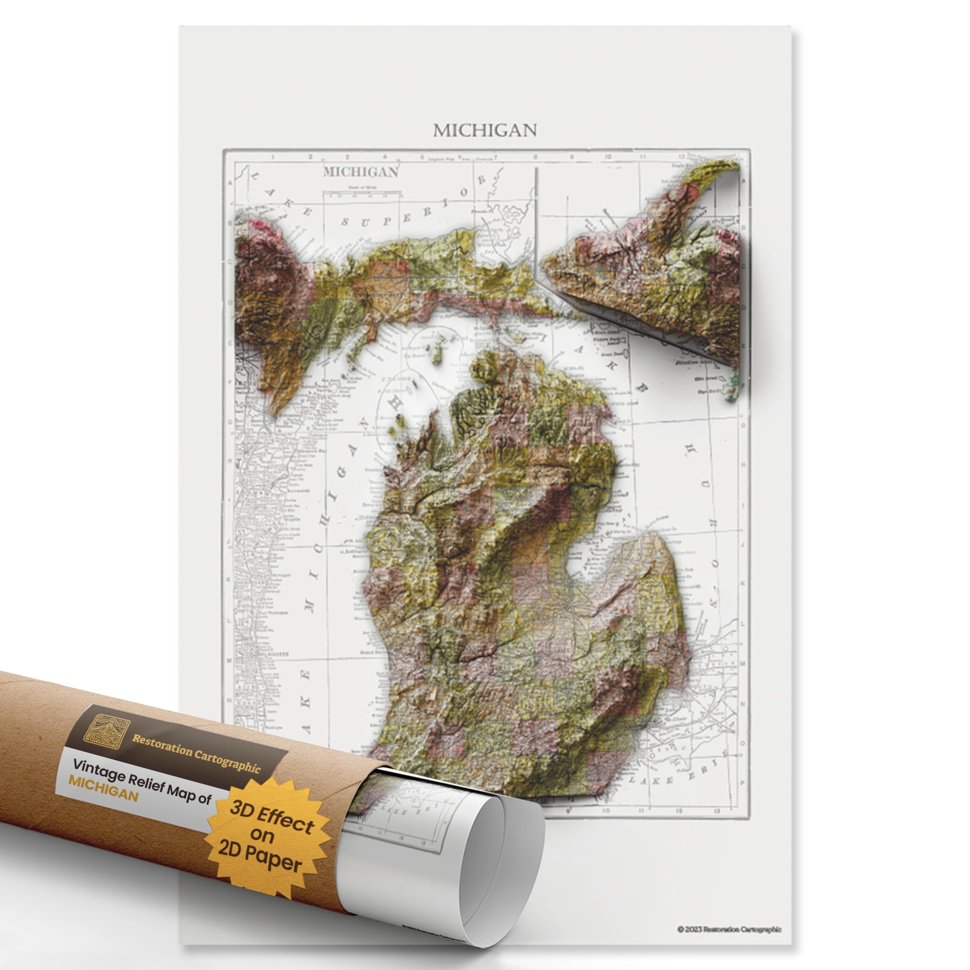
2D PRINT WITH 3D EFFECT: This is a flat paper print, not a raised or physical 3D map. Using advanced shading techniques, we create the illusion of sculpted terrain on two-dimensional poster. The result is visually striking but completely smooth to the touch and easy to frame MAPS OF THE WORLD: Discover the topographic and historical charm of Michigan with this meticulously restored 1909 Michigan map, originally commissioned by the United States Department of Agriculture Soil Conservation Service. Part of our Vintage Series, this 2D print showcases the state's intricate topography and landmarks in exquisite detail, making it a unique and captivating piece of both history and art. DIGITAL SHADOWING FOR ARTISTIC EFFECT: After restoration, our designers apply shadows across the vintage map to simulate natural light and elevation, creating a 3D-like illusion. Because this is designed as wall art, not a reference map, some text labels may be partially obscured or distorted up close—prioritizing visual depth over functional detail WALL-MOUNTED MEMORIES: More than a map, Restoration Cartographic posters tell a visual story—of home, travel, or your favorite place on earth. We bring beauty and meaning to your walls, whether in a cozy cabin, sleek office, or creative studio, enhancing your decor with a blend of historical cartography and artistic elegance AVAILABLE IN THREE SIZES: Choose from 12 x 18", 20 x 30", or 24 x 36" to fit your space. Printed on premium matte photographic paper for rich color and sharp contrast; ideal for framing and gifting. Also available: Countries Series, American States Series, American Islands Series, American Lakes Series, Minimalist Series. Introducing Restoration Cartographic Michigan Restored Vintage Relief Maps: Where Artistry and Geography Converge. Immerse yourself in the captivating illusion of depth with our Shaded Relief Maps, brought to you by Restoration Cartographic. This beautifully detailed Michigan relief map is part of our American States Series and makes for an elegant 12x12 map of Michigan styled to fit any home or office decor. Whether you're seeking a historically rich Michigan map or a precise topographic map Michigan, this piece offers both visual beauty and geographic value. Our meticulous craftsmanship blends the timeless beauty of cartography with cutting-edge digital shading, producing a visual masterpiece that will leave you in awe. The landscapes within our curated collections transcend the boundaries of paper, springing to life and transforming your walls. Whether you're a seasoned globetrotter, a passionate wanderer, or simply yearning for the warmth of home, these prints are more than decorative pieces; they are artistic expressions that narrate your personal journey. From a vintage Michigan topographical map to a modern Michigan elevation map, each print brings the essence of place into your space. Our journey commences with the curation of maps from diverse origins, encompassing antiquated governmental surveys and venerable atlas volumes. While these chosen prints might bear the signs of age, they exude a remarkable capacity for rejuvenation. Every print boasts a distinctive theme—land, sea, or sky—and even the pathways that traverse them. Each Michigan geography map undergoes meticulous restoration and digital enhancement, ensuring historical accuracy blends seamlessly with artistic refinement. The result is a stunning map of Michigan that pays tribute to both design and discovery.