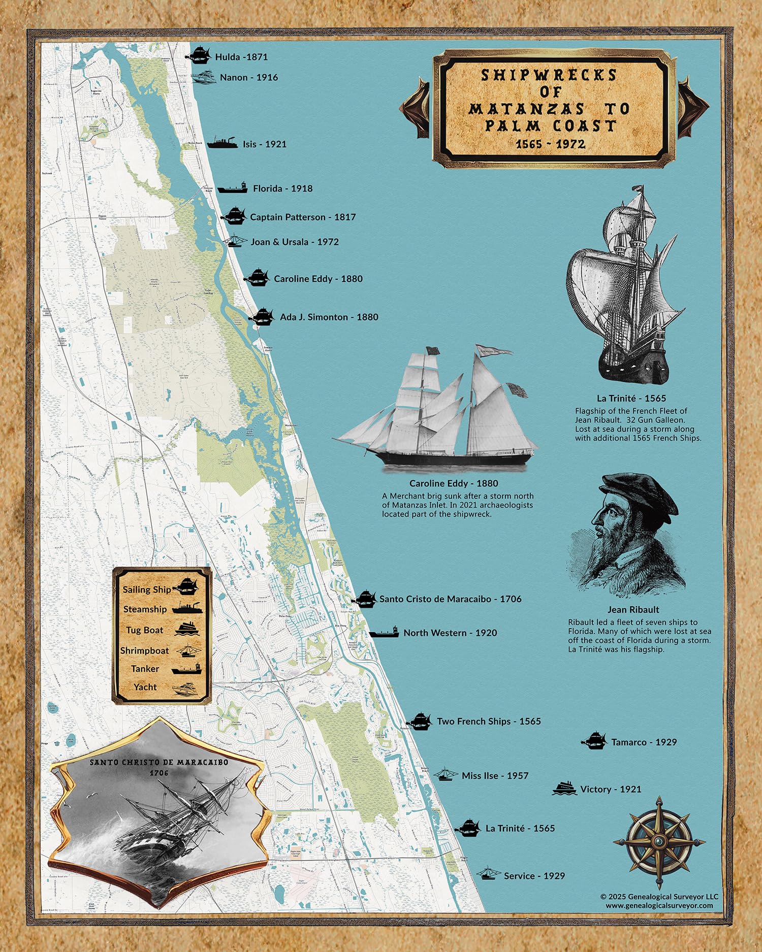
16" x 20" or 20" x 24" Full Color Map Map is made of heavy weight matte archival paper or fine art canvas. Canvas prints have an additional one inch white border all the way around for mounting if needed. Shipped in a roll map tube. This map shows Shipwrecks from Matanzas Inlet to Palm Coast, Florida during the time frame of 1565 to 1972. Including ships names, wreck dates, shore line detail, onshore roads and place names, ship inset drawings, and more.