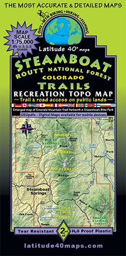
Map Coverage: Covers all or part of 45 USGS 1:24,000 7.5-minute topographic maps Northern map edge – Wyoming/ Colorado border - Southern map edge – Town of Yampa/ Top of Red Dirt Res/ Top of Wolford Res. - Eastern map edge – Lake John SWA, Sheep Mtn, Green Ridge, Poison Ridge - Western map edge – Town of Oak Creek, The Sleeping Giant (Elk Mtn) - Size: 38.25” × 25.2” flat - 8.4″ × 4.2″ folded - Scale: 1:75,000 or 1”=1.2 mi. or 2.0 km - Enlarged map of Steamboat Springs (Scale 1:37,500 or 1”= 0.6 mi. or 1.0 km.) showing Emerald Mtn Tr. Network and Steamboat Bike Park - Contour Interval: 80 feet with shaded relief base - Latest Edition: 2nd – 2020 - Notes: 2-sided – north half on one side, south half on the reverse side - Enlarged map of Steamboat Springs (Scale 1:37,500 or 1”= 0.6 mi. or 1.0 km.) showing Emerald Mtn Tr. Network and Steamboat Bike Park - Latitude and longitude map borders/ UTM coordinate grid - List of 63 Trail/Route options with difficulty ratings, distance, length, and elevation gain and loss - Public access trails and roads for all types of backcountry recreationists - Stagecoach State Park, Steamboat Lake State Park, and Pearl Lake SP. - Dozens of State Wildlife areas, State Trust Lands, and BLM lands. - Mount Zirkel Wilderness, Sarvis Wilderness, and Troublesome WSA - The CDT (Continental Divide National Scenic Trail) from Wyoming/Colorado border south to Poison Ridge