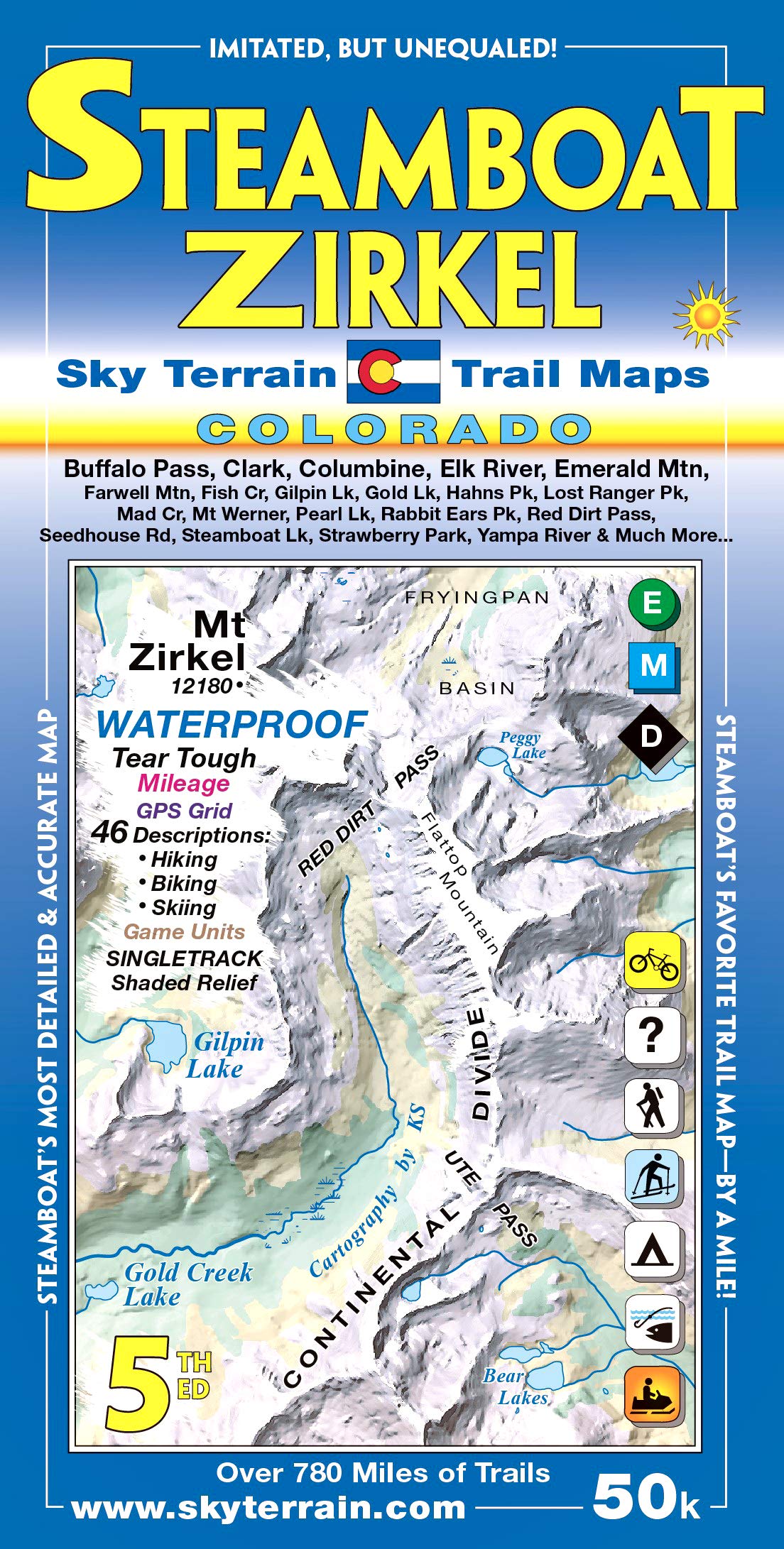
New 3rd edition topographic shaded relief trail map covers the Steamboat Springs and Mount Zirkel area in fine detail. This is the favorite map of locals & tourists alike; hikers, bikers, campers, fishermen, hunters & skiers all love this map. Several trails published here for the first time. The map is printed on Waterproof, Tear-tough material. 46 Trail descriptions! All trails are rated easy, moderate or difficult, with mileage shown between junctions. Singletrack trails for mountain biking are highlighted. Road biking also shown. Game Units shown for hunting. The map scale is 1:50,000, covering 16 USGS Quads. Contour interval is 80ft. And a 2km UTM grid makes GPS use a snap. Some of the more well known spots on the map include Rabbit Ears Pass, Fish Creek, Emerald Mountain, Buffalo Pass, Gold Creek Lake, Gilpin Lake, Seedhouse Road, Hahns Peak, Lost Ranger Peak, Mount Zirkel, Red Dirt Pass, Luna Lake, Steamboat Lake, Mad Creek, Elk River, Yampa River, Wyoming Trail and so much more. Seeing is believing!