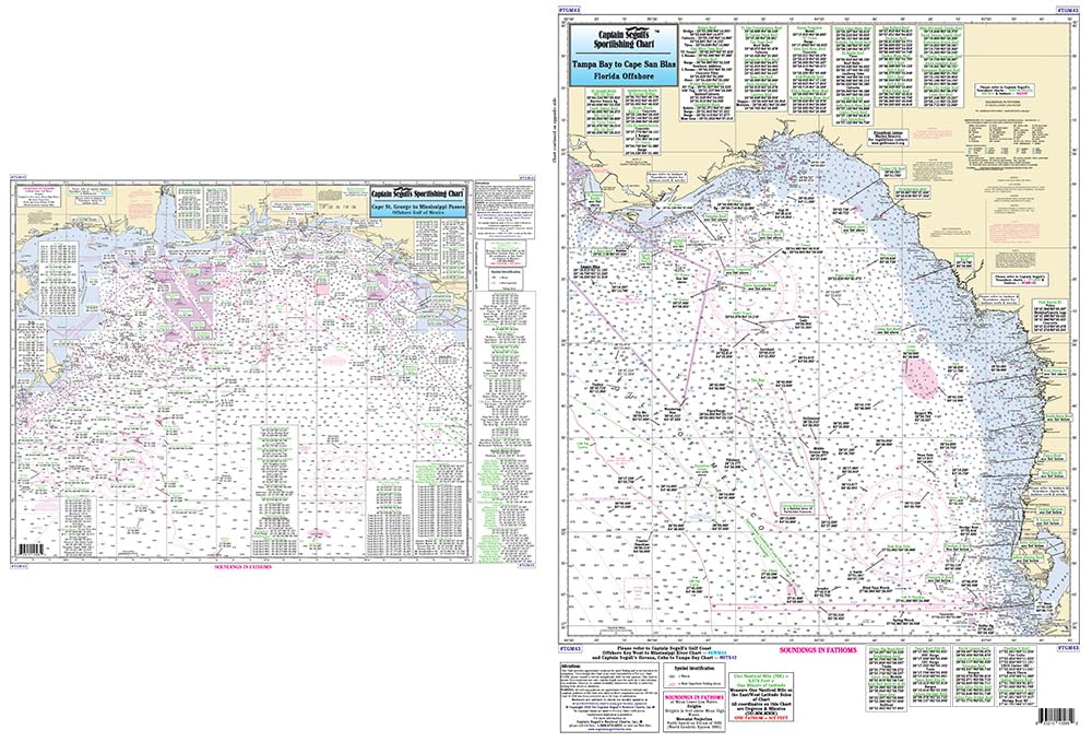
Tampa, FL to Mississippi River, LA - Laminated Nautical Navigation & Fishing Chart by Captain Segull's Nautical Sportfishing Charts | Chart # TGM43
$27.95
by Captain Segull's Sportfishing Chart
Laminated Fishing Chart Offshore Fishing Chart: An offshore chart 90 to 100 miles off the coast. From Tampa Bay to the Mississippi River, LA Double sided laminated fishing Chart. Shows fishing areas, wrecks, reefs, local names and amenities in GPS out to the thousandths of a minute. 19.5" x 26.5"