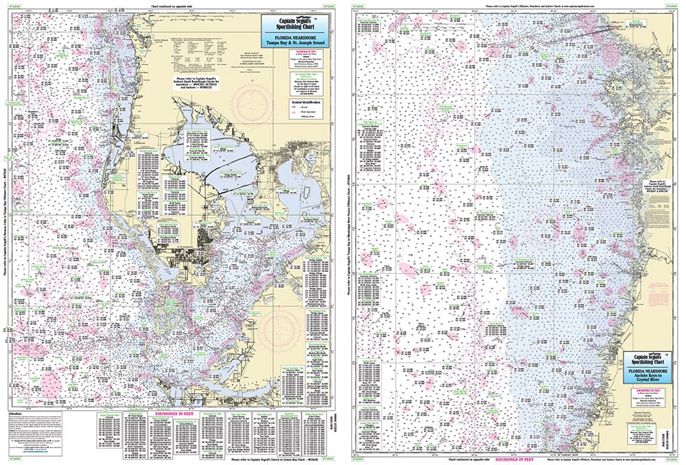
Tampa Bay to Crystal River, FL - Laminated Nautical Navigation & Fishing Chart by Captain Segull's Nautical Sportfishing Charts | Chart # TAM40
$27.95
by Captain Segull's Sportfishing Chart
Laminated Fishing Chart Nearshore Fishing Chart: A nearshore chart 20 to 30 miles out. Side A from Anna Maria Island to Tarpon Springs, with Tampa Bay and St. Joseph Sound. Side B from Ancolte Keys to Crystal River sDouble sided laminated fishing Chart. Shows fishing areas, wrecks, reefs, local names and amenities in GPS out to the thousandths of a minute. 19.5" x 26.5"