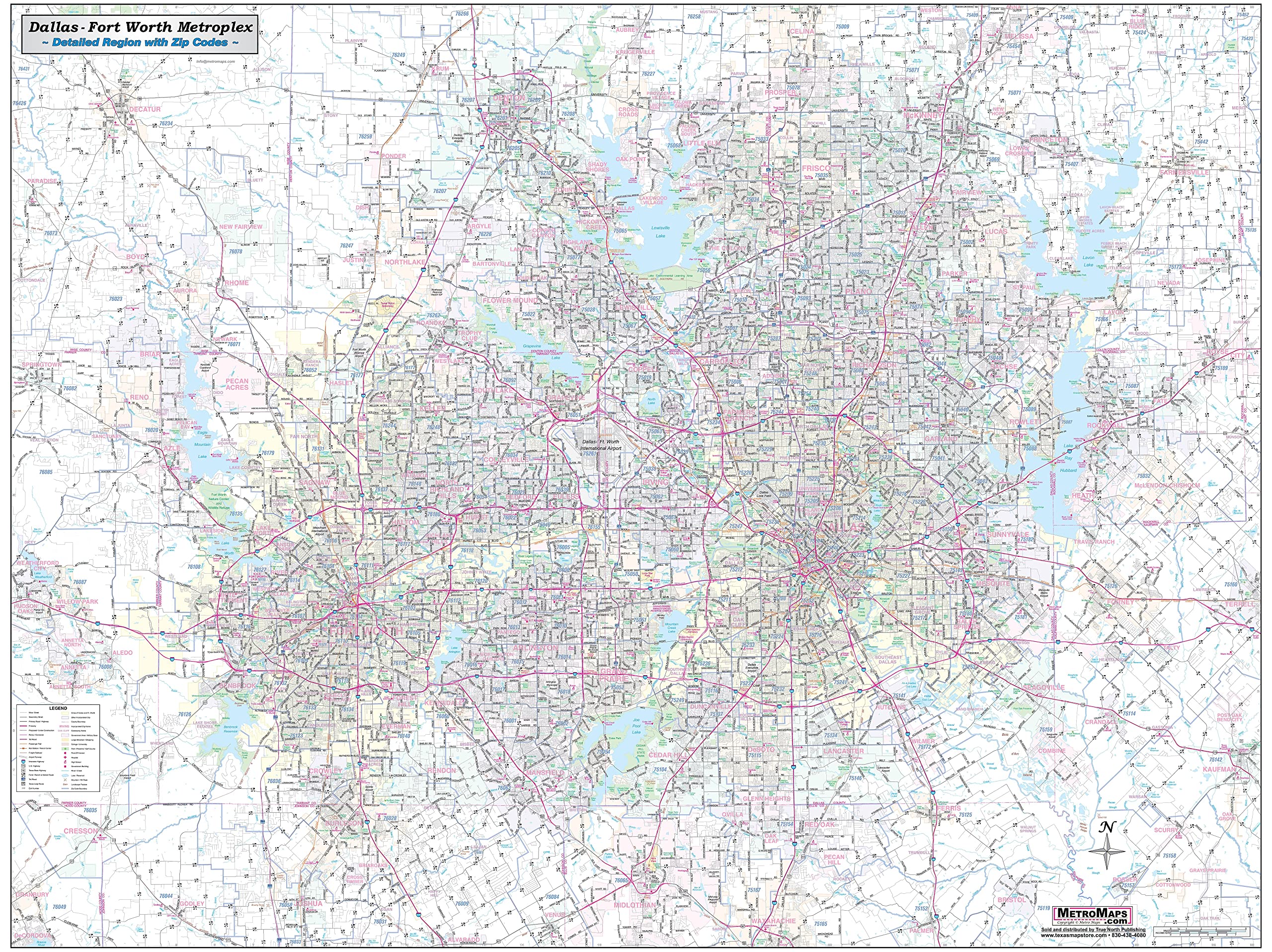
Texas Map Store Dallas & Fort Worth Regional Area Major Arterial Wall Map, Laminated, Full Color, 42"H x 54"W
$119.00
by Texas Map Store
This up to date map of the Dallas and Fort Worth regional area features up-to-date major roads, cities, highways, zip code boundaries, lakes, hospitals, high schools and more. Every street is shown, with all major roads labeled (including all Farm-to-Market designations). Freeways (with exit numbers), toll roads, passenger and freight rail lines + stations, airports, marinas, hospitals, colleges, parks, high schools, military installations, major points of interest, rivers, major terrain features, and current zip codes are all included. Map coverage area: West to include Willow Park and Decatur, North include Denton, Prosper and Melissa, East to include Royse City and Kaufman and South to include Midlothian and Joshua Laminated which makes it perfect for dry-erase markers 42"H x 54" W Area of coverage includes: West to include Willow Park and Decatur, North to include Denton, Prosper and Melissa, East - to include Royse City and Kaufman and South to include Midlothian and Joshua.