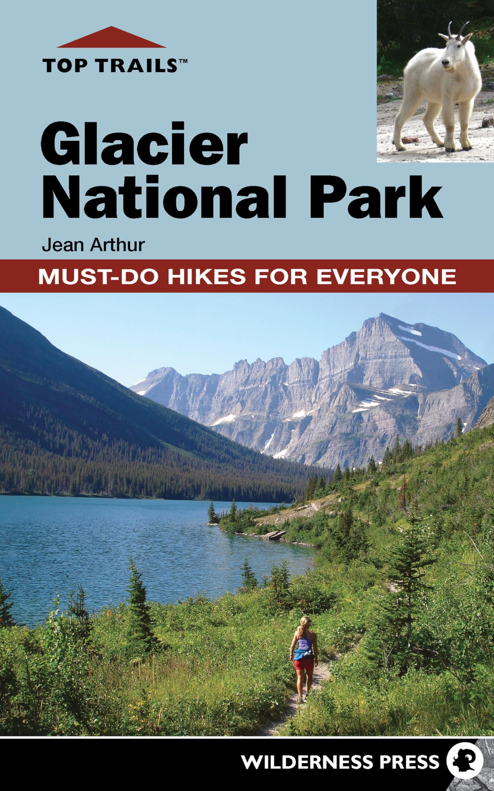
Whatever you’re looking for, there’s a trail for you at Glacier National Park. Written by local author Jean Arthur, Top Trails: Glacier National Park leads visitors to secluded trails and unique settings while providing details of current and past human activity, wildlife movement, and geologic changes that altered the landscape and created America's tenth national park. The unique approach of Top Trails: Glacier National Park reveals the best trails that wind alongside sensitive meadows and climb above crystalline lakes and leads hikers to backcountry respites unique to Glacier. The guide also traces outlaws, poachers, and mining ventures that occurred inside the current park boundary. "An unforgettable day in the park only takes a little planning and a little help, which is where former Whitefish resident Jean Arthur comes in." --Brianna Loper, Whitefish Pilot Jean Arthur hiked 400 miles of Glacier's trails during 2012 and 2013, retracing routes she's been hiking for 30 years, and spent hours with park historians, Blackfeet Indian guides, and in libraries among historic collections of Glacier's artifacts. She lives in Bozeman, MT. Trail #1: Trail of the Cedars Trail Use: Day hiking, child-friendly, wheelchair accessible Length: 0.95 mile, 30-45 minutes Vertical Feet: +32'/-32' Difficulty: Level 1 Trail Type: Loop Surface Type: Pavement and boardwalk Start & End: N48° 40.822' W113° 49.145' FEATURES Flora Secluded Birds Wildlife Views FACILITIES Restroom, Water Campground Ranger residence Shuttle Picnic area Phone This loop trail circles through a grove of western red cedars, some of which are 80 feet tall and 15 feet around at the base. These lacy trees are among the easternmost groves of water-loving western red cedars―not a true cedar but an evergreen cypress and the only Thuja species native to western North America. Its flat and lacy foliage is fragrant when crushed. Trail of the Cedars is a must-do hike for all visitors and a fine choice for the first hike of a park visit. It exemplifies why Glacier is unique; the 1.2-million-acre park encompasses three very different ecosystems. The microclimate here is more akin to the Pacific Northwest’s wet and temperate forest, while just 30 miles east, over the Continental Divide, begin the vast semiarid prairies of Montana. Best Time Spring, summer, and fall, this trail is popular because of its gentle terrain and accessibility from Going-to-the-Sun Road. During hot summer days, the trail remains cool under the huge western red cedars, which act as an umbrella for hikers during inclement weather. During winter, access via cross- country ski or snowshoe is from the winter trailhead at Lake McDonald Lodge and is a 5.8-mile one-way ski. The Trail of the Cedars tends to be icy in winter, so caution is necessary. Finding the Trail From Lake McDonald Lodge, drive north on Going-to-the-Sun Road 5.8 miles to the Avalanche Campground, and park in the day-use parking either on your left or along the road in designated day-use parking spots. If taking the free shuttle (available July 1 to Labor Day) from Apgar Transit Center, the trailhead will be 14.7 miles northeast on Going-to-the-Sun Road. Listen for the shuttle driver’s announcement for Avalanche Creek. The trailhead sign at the junction of the road and Avalanche Creek will direct you to walk east along the mixed pavement and boardwalk trail. Trail Description The trail can be hiked in either direction; this description details a counterclockwise loop beginning on the south side of Avalanche Creek and walking east, where you can glimpse frothy Avalanche Creek with its moss-covered rocks and fishing holes and will encounter a campground, an amphitheater, and a restroom on the south side of the trail. Cedars have a fire-resistant quality, thanks to thick bark and moist soils near streams or another body of water. Some trees in this grove are estimated to be nearly 500 years old. Although lightning has started fires nearby, these hardy cedars managed to remain protected. Interpretive signs offer some insight into flora and fauna. Mostly, however, you’ll see fellow hikers, strollers, walkers, and wheelchairs. Near the halfway point, the trailhead for Avalanche Lake leads east and is clearly marked. Stay on the loop for a magnificent view from a large footbridge at Avalanche Creek gorge. Eons of icy waters have scoured the rock smooth. Beware of the very cold and very fast water. As noted by signs at the Avalanche Lake Trailhead, more people die each year in Glacier from drowning than from any other cause. The canopy from the cedars and a few hemlocks and cottonwoods is so thick that few shrubs grow here. Notice, however, the fungi and saprophytes (organisms that live on decaying organic matter) that do not rely upon photosynthesis and can thrive in the subdued light. MILESTONES 1. 0.0 Start from Going-to-the-Sun Road at Avalanche Creek and Avalanche parking area. 2. 0.03 Trail of