Upper Chesapeake Bay - Laminated Nautical Navigation & Fishing Chart by Captain Segull's Nautical Sportfishing Charts | Chart # CBU120
$16.95
by Captain Segull's Sportfishing Chart
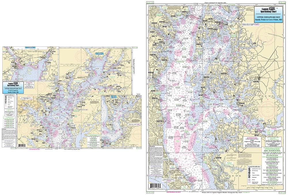
Laminated Fishing Chart Inshore Fishing Chart: An inshore chart of the Upper Chesapeake Bay side A, extends from the C & D Canal to Sandy Point, MD, with an inset of the Susquehanna River and Northeast River. Side B, from Sandy Point, MD to Cove Point. MD Shows fishing areas, wrecks, reefs, local names and amenities in GPS out to the thousandths of a minute. 19.5" x 26.5" Uses NOAA Charts 12263 & 12273