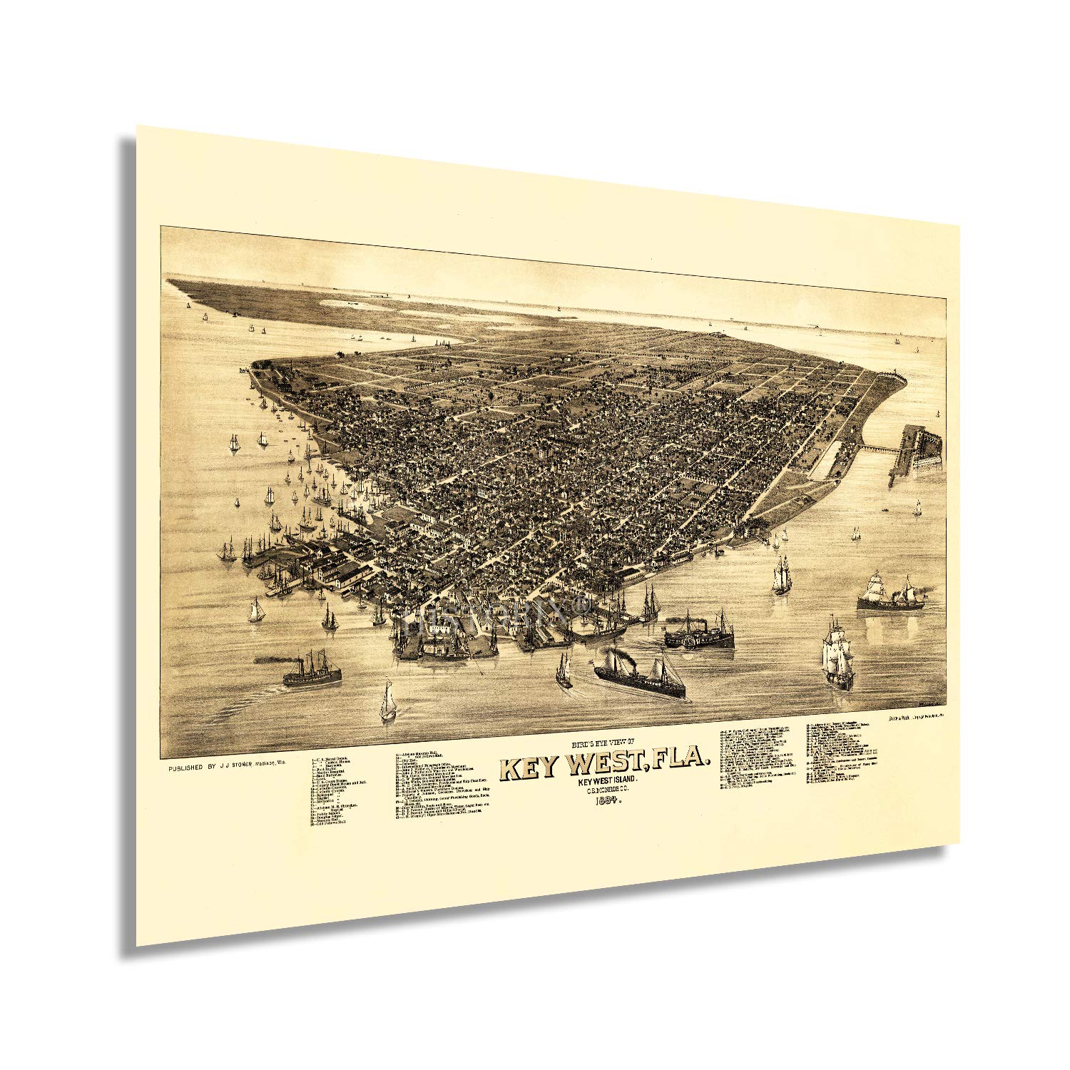
Produced and illustrated by one of the most prolific American lithographers and cartographers, Henry Wellge, this birds-eye perspective of Key West shows the iconic line of islands in a period of significant growth and transformation. Wellge is among five producers responsible for more than half of all panoramic maps contained in the Library of Congress. The region had experienced significant growth in population as immigrants fled Cuba during the Ten Years War between Spain and Cuban patriots. By 1889 Key West had become the most wealthy city in Florida. However, it would remain relatively isolated until it was connected to the mainland with the Overseas Railway's construction.
Birdseye perspectives were among the most popular illustrations during the late nineteenth century until the 1920s and were used to promote civic features to attract residents and merchants alike. Wellge’s unique style and distinctive aesthetic immediately transports the viewer back in time, creating an indelible bond between the past and present. Though Wellge was based in Wisconsin, he produced panoramic maps of many popular cities throughout the Northeast and South.
The USS Maine sailed from Key West to Havana, where she was blown up and sank. The event would be the spark for the Spanish-American War as tensions had grown between the United States and Spain over their control of Cuba and military presence in the region. Key West remains one of the most iconic regions in the United States and has attracted tourists to its clear waters for more than three centuries.
Our museum quality giclee print comes printed with archival ink on premium heavyweight matte paper. Shipped in a sturdy cardboard tube your print will arrive ready to be framed. This eye-catching vintage map reproduction print makes the perfect gift for anyone that loves history and imagery.