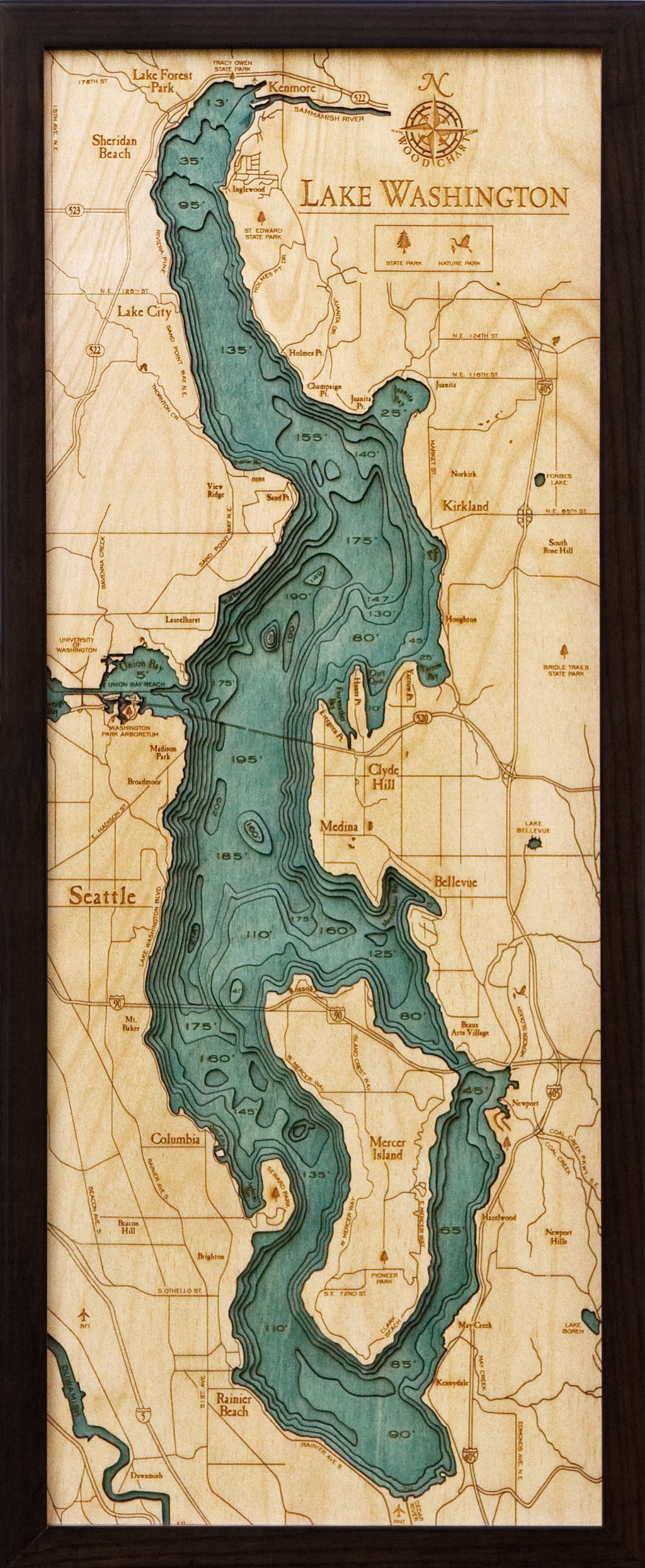
Laser etched and cut, hand stained and hand assembled Three-dimensional Baltic wood chart depicting the contours of underwater topography Ready to hang with mounting instructions on the back Dimensions: 31"h x 24.5"w, 1-7/8" frame depth WoodChart's beautiful map of Lake Washington. A 3-D nautical wood map featuring Lake Washington, in King County, Washington. A large, freshwater, ribbon lake that's adjacent to the city of Seattle, Lake Washington is fed by the Sammamish River at its north end and the Cedar River at its south. It's connected to the Puget Sound by Lake Union and a series of man made locks and is spanned east-west by the world's longest, second-longest and fifth-longest floating bridges. Points of Interest: Seattle, Mercer Island, Rainier Beach, Pioneer Park, Columbia, Bellevue, Union Bay, Washington Park Arboretum and St. Edward State Park. Our wood charts are made from Baltic birch and have a solid wood frame. They come ready to hang.